
IMAGES TAKEN NEAR TO
Edinburgh Road, STRANRAER, DG9 7HF
Introduction
This page details the photographs taken nearby to Edinburgh Road, DG9 7HF by members of the Geograph project.
The Geograph project started in 2005 with the aim of publishing, organising and preserving representative images for every square kilometre of Great Britain, Ireland and the Isle of Man.

There are currently over 7.5m images from over14,400 individuals and you can help contribute to the project by visiting https://www.geograph.org.uk
Image Map
Images are licensed for reuse under creativecommons.org/licenses/by-sa/2.0
Notes
- Clicking on the map will re-center to the selected point.
- The higher the marker number, the further away the image location is from the centre of the postcode.
Image Listing (421 Images Found)
Images are licensed for reuse under creativecommons.org/licenses/by-sa/2.0
Image
Details
Distance
1
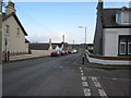
Edinburgh Road
At the junction with Victoria Place.
Image: © Billy McCrorie
Taken: 15 Nov 2011
0.02 miles
3
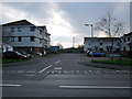
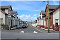
Burnside Court
At the junction with the Edinburgh Road.
Image: © Billy McCrorie
Taken: 15 Nov 2011
0.03 miles
4
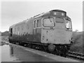
Diesel locomotive - Stranraer Town station
While Stranraer Town station closed in 1966, the site remained open for locomotive storage with the area cleared and buildings demolished only in the early years of the 21st Century. On a miserable July day, BR Class-27 No. 27029 stands in the former town station waiting its next duty. This locomotive entered service in February 1962, was withdrawn on 13 January 1986 and scrapped in 1987.
Image: © The Carlisle Kid
Taken: 7 Jul 1978
0.03 miles
5
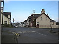
Victoria Place
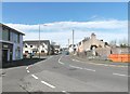
Junction of Victoria Place and the Edinburgh Road, straight across is Lochryan Street.
Image: © Billy McCrorie
Taken: 15 Nov 2011
0.03 miles
8
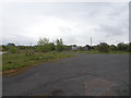
Stranraer Town railway station (site), Dumfries & Galloway
Opened in 1862 by the Portpatrick Railway on what became the Portpatrick & Wigtownshire Joint Railway from Castle Douglas to Portpatrick, this station closed to passengers in 1966 and to freight in 2009.
View south at the former forecourt. The station building would have been directly in front of us and behind it, the single curving platform was probably still extant when this image was taken, but the site was derelict.
Image: © Nigel Thompson
Taken: 8 May 2019
0.06 miles
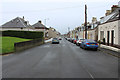
10
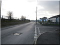
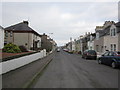
Station Street
From the junction with McCormack Gardens. Station Street runs on to the Edinburgh Road.
Image: © Billy McCrorie
Taken: 15 Nov 2011
0.06 miles