IMAGES TAKEN NEAR TO
Leswalt, STRANRAER, DG9 0NA
Introduction
This page details the photographs taken nearby to DG9 0NA by members of the Geograph project.
The Geograph project started in 2005 with the aim of publishing, organising and preserving representative images for every square kilometre of Great Britain, Ireland and the Isle of Man.

There are currently over 7.5m images from over14,400 individuals and you can help contribute to the project by visiting https://www.geograph.org.uk
Image Map
Images are licensed for reuse under creativecommons.org/licenses/by-sa/2.0
Notes
- Clicking on the map will re-center to the selected point.
- The higher the marker number, the further away the image location is from the centre of the postcode.
Image Listing (9 Images Found)
Images are licensed for reuse under creativecommons.org/licenses/by-sa/2.0
Image
Details
Distance
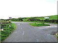
1
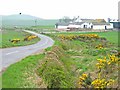
Junction of the B738 and a minor road to Leswalt
Image: © Ann Cook
Taken: 19 May 2011
0.13 miles
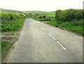
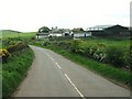
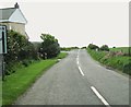
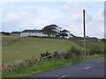
6
House at Knock, North Rhins
On the B738. There are a number of windfarms in the area, but there is no suggestion that the windmill in this garden is generating any electricity!
Image: © Oliver Dixon
Taken: 30 Apr 2006
0.18 miles
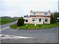
7
Portslogan farm
Viewed from Portslogan Bridge.
Image: © Russel Wills
Taken: 7 Sep 2022
0.18 miles