IMAGES TAKEN NEAR TO
Millbank Road, STRANRAER, DG9 0EJ
Introduction
This page details the photographs taken nearby to Millbank Road, DG9 0EJ by members of the Geograph project.
The Geograph project started in 2005 with the aim of publishing, organising and preserving representative images for every square kilometre of Great Britain, Ireland and the Isle of Man.

There are currently over 7.5m images from over14,400 individuals and you can help contribute to the project by visiting https://www.geograph.org.uk
Image Map
Images are licensed for reuse under creativecommons.org/licenses/by-sa/2.0
Notes
- Clicking on the map will re-center to the selected point.
- The higher the marker number, the further away the image location is from the centre of the postcode.
Image Listing (129 Images Found)
Images are licensed for reuse under creativecommons.org/licenses/by-sa/2.0
Image
Details
Distance
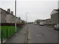
1
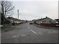
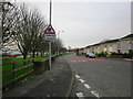
Millbank Road
Millbank at the junction with Leswalt High road.
Image: © Billy McCrorie
Taken: 11 Nov 2011
0.05 miles
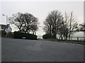
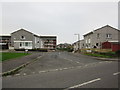
2
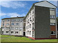
Kyntire Court
Intriguing block of flats with a three-pointed ground plan.
Image: © Jonathan Wilkins
Taken: 30 Jul 2012
0.05 miles
3
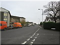
Sheuchan Street
From the junction with Broadstone road.
Image: © Billy McCrorie
Taken: 11 Nov 2011
0.06 miles
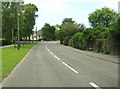
4
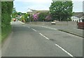
Leswalt High Road at the junction with Millbank Road
Image: © Ann Cook
Taken: 20 May 2011
0.07 miles
5
Sheuchan Street
From Broadstone road junction, Loch Ryan is over on the left.
Image: © Billy McCrorie
Taken: 11 Nov 2011
0.08 miles
6
Broadstone Road
Junction of Broadstone Road and Sheuchan Street.
Image: © Billy McCrorie
Taken: 11 Nov 2011
0.08 miles
7
Leswalt High Road approaching the junction with Spring Bank Road
Image: © Ann Cook
Taken: 20 May 2011
0.08 miles
8
Spring Bank Road
At junctions with Brookfield Crescent and Leswalt High Road.
Image: © Billy McCrorie
Taken: 11 Nov 2011
0.08 miles
9
Sheuchan Street
From the junction with West End Terrace back towards the town.
Image: © Billy McCrorie
Taken: 11 Nov 2011
0.09 miles
10
Corsewall Crescent
From the junction with Leswalt High Road.
Image: © Billy McCrorie
Taken: 11 Nov 2011
0.09 miles