
IMAGES TAKEN NEAR TO
Whauphill, NEWTON STEWART, DG8 9PN
Introduction
This page details the photographs taken nearby to DG8 9PN by members of the Geograph project.
The Geograph project started in 2005 with the aim of publishing, organising and preserving representative images for every square kilometre of Great Britain, Ireland and the Isle of Man.

There are currently over 7.5m images from over14,400 individuals and you can help contribute to the project by visiting https://www.geograph.org.uk
Image Map
Images are licensed for reuse under creativecommons.org/licenses/by-sa/2.0
Notes
- Clicking on the map will re-center to the selected point.
- The higher the marker number, the further away the image location is from the centre of the postcode.
Image Listing (11 Images Found)
Images are licensed for reuse under creativecommons.org/licenses/by-sa/2.0
Image
Details
Distance
1
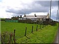
Roadside cottage
On the B7085 Portwilliam to Wigtown road.
Image: © Oliver Dixon
Taken: 1 May 2006
0.01 miles
2
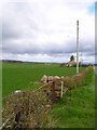
Roadside hedge on the B7085
Portwilliam to Wigtown road.
Image: © Oliver Dixon
Taken: 1 May 2006
0.07 miles
3
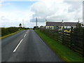
Drumtroddan Cottages
View of these cottages which are at the side of the B7085.
Image: © Andy Farrington
Taken: 28 Aug 2010
0.10 miles
4
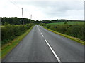
Drumtroddan Cottages
View down the B7085 taken from near to these cottages. The road off right leads to Burnside and Meikle Killantrae Farm.
Image: © Andy Farrington
Taken: 28 Aug 2010
0.10 miles
5

Landberrick Farm
View from the farm up the B7085 in the direction of Port William. The wind turbine on Landberrick Hill right of picture is becoming more common in Dumfries and Galloway and most local agricultural shows have a trade stand selling them to land owners and farmers.
Image: © Andy Farrington
Taken: 28 Aug 2010
0.10 miles
6
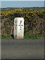
Old milestone
Just southwest of Lanberrick, another milestone painted by a Milestone Society member. On the very edge of the road but highlighted by the yellow gorse in Springtime.
Image: © Chris Minto
Taken: 20 Apr 2023
0.11 miles
7

Old milestone
Easy to find this milestone near the wind turbines.
Image: © Chris Minto
Taken: 20 Apr 2023
0.11 miles
8
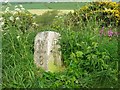
Old Milestone by the B7085, Landberrick, Mochrum parish
Milestone by the B7085, in parish of Mochrum (Wigtownshire District), between telegraph poles, on verge, Northwest side of road.
Inscription
: W / {arrow->} / 8 : : P / {<-arrow} / 2 :
(To Wigtown and Port William)
Surveyed
Milestone Society National ID: DG_WGPW08
Image: © Milestone Society
Taken: Unknown
0.11 miles
9

Burnside Cottage
View past the cottage to Burnside Bridge which spans Killantrae Burn.
Image: © Andy Farrington
Taken: 28 Aug 2010
0.21 miles
10

Meikle Killantrae
View along the full length of this unnamed road. Left of picture on the horizon are Drumtroddan Cottages Image and right of picture is Downsbank Cottage Image and Drumtroddan Plantation all on the B7085.
Image: © Andy Farrington
Taken: 1 Dec 2010
0.21 miles