
IMAGES TAKEN NEAR TO
Kirkinner, NEWTON STEWART, DG8 9AL
Introduction
This page details the photographs taken nearby to DG8 9AL by members of the Geograph project.
The Geograph project started in 2005 with the aim of publishing, organising and preserving representative images for every square kilometre of Great Britain, Ireland and the Isle of Man.

There are currently over 7.5m images from over14,400 individuals and you can help contribute to the project by visiting https://www.geograph.org.uk
Image Map
Images are licensed for reuse under creativecommons.org/licenses/by-sa/2.0
Notes
- Clicking on the map will re-center to the selected point.
- The higher the marker number, the further away the image location is from the centre of the postcode.
Image Listing (155 Images Found)
Images are licensed for reuse under creativecommons.org/licenses/by-sa/2.0
Image
Details
Distance
1
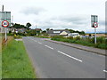
Braehead
View of the Braehead boundary sign and entrance to the village taken from the A746 looking northwards. To the right of picture are vehicles parked up in Kirkinner Bus Depot Image
Image: © Andy Farrington
Taken: 8 Aug 2010
0.02 miles
2
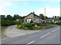
Braehead
View of this property which is the first or last house in Braehead depending on your direction of travel. The view of the garden though is always heartening because it is so well kept.
Image: © Andy Farrington
Taken: 7 Aug 2010
0.03 miles
4
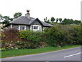
Station House, Braehead
Site of the former station house for Kirkinner Station although it is found geographically in Braehead.
Image: © Andy Farrington
Taken: 8 Aug 2010
0.03 miles
5
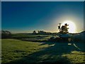
Big Yellow Ball in the Sky
A crisp and sunny day in Braehead captured on my walk to the local shop on Boxing Day to pick up the papers and have a natter.
Image: © Andy Farrington
Taken: 26 Dec 2013
0.04 miles
7
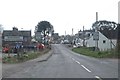
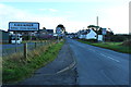
Entering Kirkinner
On the A746 to Garlieston
Image: © Anthony O'Neil
Taken: 28 Apr 2017
0.05 miles
8
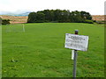
Braehead Football Pitch
View across the local football pitch to open ploughed fields and Wigtown Bay on the horizon. The sign says that Wigtown District Council has made byelaws prohibiting or practising golf on this land (the football pitch) with a maximum fine of £500 to look forward to. Which all seems a bit odd in a land where golf is so popular.
Image: © Andy Farrington
Taken: 7 Aug 2010
0.05 miles
9
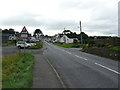
Kirkinner
View along the A746 with the village sign and plenty of notice that a school is near. Kirkinner Primary School is left of picture at the side of the monkey puzzle tree.
Image: © Andy Farrington
Taken: 7 Aug 2010
0.05 miles
10

Former station at Kirkinner, 2000
View northward on the A746, towards Newton Stewart: ex-Portpatrick & Wigtownshire (CR, GSWR, LNWR & MR) Joint branch Newton Stewart - Wigtown, the station having been closed along with the branch passenger service since 25/9/50, but goods continued to Whithorn until 5/10/64 (calling here until 5/10/59).
Image: © Ben Brooksbank
Taken: 24 Jun 2000
0.05 miles