
IMAGES TAKEN NEAR TO
Braehead, NEWTON STEWART, DG8 9AH
Introduction
This page details the photographs taken nearby to Braehead, DG8 9AH by members of the Geograph project.
The Geograph project started in 2005 with the aim of publishing, organising and preserving representative images for every square kilometre of Great Britain, Ireland and the Isle of Man.

There are currently over 7.5m images from over14,400 individuals and you can help contribute to the project by visiting https://www.geograph.org.uk
Image Map
Images are licensed for reuse under creativecommons.org/licenses/by-sa/2.0
Notes
- Clicking on the map will re-center to the selected point.
- The higher the marker number, the further away the image location is from the centre of the postcode.
Image Listing (101 Images Found)
Images are licensed for reuse under creativecommons.org/licenses/by-sa/2.0
Image
Details
Distance
1
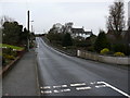
Braehead at 1.11 pm on 1.1.11
Picture of the A746 at Braehead at it crosses over Mildriggan Bridge on its route to Bladnoch. The bridge is single lane only with traffic having to stop and give way in this direction of travel.
Image: © Andy Farrington
Taken: 1 Jan 2011
0.01 miles
2
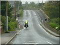
Bob the Coast Rider
Bob Jones crossing Mildriggan Bridge in Braehead starting the 53rd stage of a bike journey of nearly 6000 miles around the coasts of England, Scotland and Wales. A slightly later start at 9.30am than planned with a bit of a typical Scottish drizzle to help him on his way. It must get pretty lonely at times on this solo effort for the two charities that Bob is riding for, only 46 stages to go! http://www.coastrider.org.uk.
Image: © Andy Farrington
Taken: 21 Jun 2011
0.01 miles
3
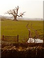
Farmland in Braehead
View across towards Maltkiln Bridge.
Image: © Andy Farrington
Taken: 2 Mar 2012
0.03 miles
4
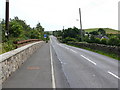
Milldriggan Bridge
View of the bridge as seen when travelling south on the A746 towards Kirkinner and Whithorn. Traffic has right of way in this direction, although I'm reliably informed that the bridge was originally two way and it has been reduced in width with the addition of footpaths across this small burn.
Image: © Andy Farrington
Taken: 7 Jul 2010
0.03 miles
5
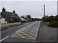
Braehead at 1.11 pm on 1.1.11
View along the A746 in Braehead in the direction of Kirkinner.
Image: © Andy Farrington
Taken: 1 Jan 2011
0.04 miles
6
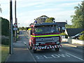
Dumfries and Galloway Fire and Rescue Service
The astute observer may notice that this fire tender is stationary, facing oncoming traffic with its lights flashing and the driver is putting his glasses on as the co-driver aka the navigator appears to be consulting a map. They are not lost nor is this a shout, more of a quiet whimper as the guys drive around the Machars to make sure that the fire hydrants are working correctly and heaven forbid in the event of a fire, we shall have water, and plenty of it. Thank you fire and rescue services of Dumfries and Galloway!
Image: © Andy Farrington
Taken: 5 Jul 2011
0.04 miles
7
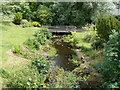
Milldriggan Bridge
View from the bridge overlooking Maltkiln Burn. This small footbridge is at the side of Milldriggan Mill (out of picture left)
Image: © Andy Farrington
Taken: 7 Jul 2010
0.04 miles
8
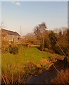
Milldriggan Bridge
View of Milldriggan Burn downstream taken from the bridge with Milldriggan Mill to the left of picture.
Image: © Andy Farrington
Taken: 2 Mar 2012
0.04 miles
9
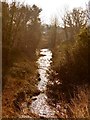
Milldriggan Burn
View of the burn upstream as it passes under Milldriggan Bridge which carries the A746 into Braehead.
Image: © Andy Farrington
Taken: 2 Mar 2012
0.05 miles
10
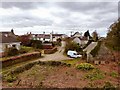
Milldriggan
Right of picture is the former Milldriggan Smithy, the view here is to the main road through Braehead, the A746. The small track centre of picture leads through a rail bridge to grazing fields. Image]
Image: © Andy Farrington
Taken: 31 Mar 2012
0.05 miles