
IMAGES TAKEN NEAR TO
Garlieston, NEWTON STEWART, DG8 8AF
Introduction
This page details the photographs taken nearby to DG8 8AF by members of the Geograph project.
The Geograph project started in 2005 with the aim of publishing, organising and preserving representative images for every square kilometre of Great Britain, Ireland and the Isle of Man.

There are currently over 7.5m images from over14,400 individuals and you can help contribute to the project by visiting https://www.geograph.org.uk
Image Map
Images are licensed for reuse under creativecommons.org/licenses/by-sa/2.0
Notes
- Clicking on the map will re-center to the selected point.
- The higher the marker number, the further away the image location is from the centre of the postcode.
Image Listing (70 Images Found)
Images are licensed for reuse under creativecommons.org/licenses/by-sa/2.0
Image
Details
Distance
1
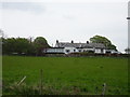
Millisle railway station (site), Dumfries & Galloway
Opened in 1877 by the Wigtown Railway on what later became the Portpatrick & Wigtownshire Joint Railway branch line from Newton Stewart to Whithorn, this station closed to passengers in 1950 and completely in 1964.
View north from the road - the platforms were behind the building. An earlier station called Garliestown stood on or near this site from 1875 to 1876 but a short branch line to Garliestown proper opened in 1876. Millisle opened at the junction to this branch line and remained open long after the short-lived branch closed to passengers in 1903.
Image: © Nigel Thompson
Taken: 8 May 2019
0.00 miles
2
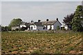
Millisle Station
Millisle Station as it is shown on the map, this would have served Garlieston as well as the local area though there is a spur leading off past the station which went to Garlieston this went down to the harbour. The main building can be seen though it has had some additions.
Image: © Bill Nicholls
Taken: 28 May 2012
0.01 miles
3
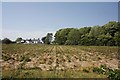
Station over the field
View over the field beside the B7052 towards the old station, the railway would have been in the tree line.
Image: © Bill Nicholls
Taken: 28 May 2012
0.02 miles
4
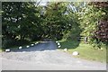
Entrance to Millisle Station
The entrance to Millisle station now a driveway to the residence there.
Image: © Bill Nicholls
Taken: 28 May 2012
0.08 miles
5
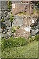
Benchmark on the bridge
A good result finding this benchmark on the old rail bridge near Garlieston.
Image: © Bill Nicholls
Taken: 28 May 2012
0.08 miles
6
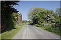
Looking back through the bridge
Looking back through the old rail bridge on the B7052 near Garlieston
Image: © Bill Nicholls
Taken: 28 May 2012
0.09 miles
7
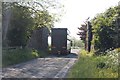
Reason for removal
This is the reason many bridge decks have been removed from these old rail bridges, to allow large lorries through as seen here on the B7052 near Garlieston.
Image: © Bill Nicholls
Taken: 28 May 2012
0.09 miles
8
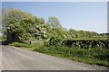
Line from the bridge
View of the embankment leading from the old Rail Bridge near Garlieston.
Image: © Bill Nicholls
Taken: 28 May 2012
0.09 miles
9

Wall at the end
The wall you see past the nettles here mark the bridge and where it has been removed. If the bridge had still been inplace you would have been heading towards Millisle Station.
Image: © Bill Nicholls
Taken: 28 May 2012
0.10 miles
10
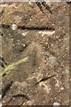
Close up of the benchmark
Close up of the benchmark on the old rail bridge near Garlieston. Image
Image: © Bill Nicholls
Taken: 28 May 2012
0.10 miles