IMAGES TAKEN NEAR TO
Garlieston, NEWTON STEWART, DG8 8AD
Introduction
This page details the photographs taken nearby to DG8 8AD by members of the Geograph project.
The Geograph project started in 2005 with the aim of publishing, organising and preserving representative images for every square kilometre of Great Britain, Ireland and the Isle of Man.

There are currently over 7.5m images from over14,400 individuals and you can help contribute to the project by visiting https://www.geograph.org.uk
Image Map
Images are licensed for reuse under creativecommons.org/licenses/by-sa/2.0
Notes
- Clicking on the map will re-center to the selected point.
- The higher the marker number, the further away the image location is from the centre of the postcode.
Image Listing (18 Images Found)
Images are licensed for reuse under creativecommons.org/licenses/by-sa/2.0
Image
Details
Distance
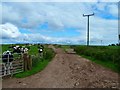
1
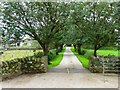
Culscadden Farm
Entrance road to the farmhouse.
Image: © Andy Farrington
Taken: 17 Aug 2011
0.02 miles
3
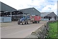
Delivery of silage
Culscadden farmyard
Image: © Anthony O'Neil
Taken: 28 Apr 2017
0.03 miles
4
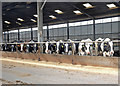
A Chorus Line
Friesian and Holstein cattle at Culscadden Farm awaiting feeding
Image: © Anthony O'Neil
Taken: 28 Apr 2017
0.03 miles
5
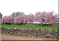
Galloway in Bloom (6)
Culscadden Farm, Garlieston
Image: © Anthony O'Neil
Taken: 28 Apr 2017
0.05 miles
6
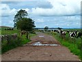
Track to Culscadden Burn
View along the track with Wigtown on the horizon.
Image: © Andy Farrington
Taken: 17 Aug 2011
0.08 miles
7
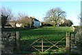
Culscadden Farm
View past the farm right of picture along the two tracks to the road. Toll the dog had to wait tied to the gate for a minute while I took my shots, too many cattle about.
Image: © Andy Farrington
Taken: 17 Aug 2011
0.08 miles
9
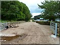
Culscadden Farm
Track at the farm that runs down to Innerwell Fishery.
Image: © Andy Farrington
Taken: 17 Aug 2011
0.08 miles
10
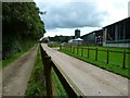
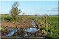
Culscadden Farm
View along the entrance roads to the farm on the right and cottages on the left.
Image: © Andy Farrington
Taken: 17 Aug 2011
0.10 miles