IMAGES TAKEN NEAR TO
Dalry, CASTLE DOUGLAS, DG7 3TX
Introduction
This page details the photographs taken nearby to DG7 3TX by members of the Geograph project.
The Geograph project started in 2005 with the aim of publishing, organising and preserving representative images for every square kilometre of Great Britain, Ireland and the Isle of Man.

There are currently over 7.5m images from over14,400 individuals and you can help contribute to the project by visiting https://www.geograph.org.uk
Image Map
Images are licensed for reuse under creativecommons.org/licenses/by-sa/2.0
Notes
- Clicking on the map will re-center to the selected point.
- The higher the marker number, the further away the image location is from the centre of the postcode.
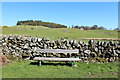
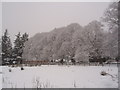
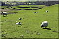
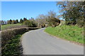
Image Listing (18 Images Found)
Images are licensed for reuse under creativecommons.org/licenses/by-sa/2.0
Image
Details
Distance
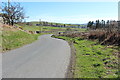
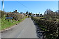
1
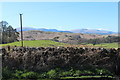
Farmland at Kenbank
This is also a view from a well placed seat.
Image: © Billy McCrorie
Taken: 16 Apr 2015
0.07 miles
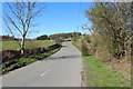
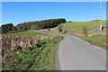
10
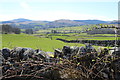
Farmland near Dalry
The pipeline on the far hill is for the Glenlee Power Station bringing water from Clatteringshaws Loch.
Image: © Billy McCrorie
Taken: 16 Apr 2015
0.21 miles