
IMAGES TAKEN NEAR TO
Crossmichael, CASTLE DOUGLAS, DG7 3AS
Introduction
This page details the photographs taken nearby to DG7 3AS by members of the Geograph project.
The Geograph project started in 2005 with the aim of publishing, organising and preserving representative images for every square kilometre of Great Britain, Ireland and the Isle of Man.

There are currently over 7.5m images from over14,400 individuals and you can help contribute to the project by visiting https://www.geograph.org.uk
Image Map
Images are licensed for reuse under creativecommons.org/licenses/by-sa/2.0
Notes
- Clicking on the map will re-center to the selected point.
- The higher the marker number, the further away the image location is from the centre of the postcode.
Image Listing (47 Images Found)
Images are licensed for reuse under creativecommons.org/licenses/by-sa/2.0
Image
Details
Distance
4

Cemetery near Crossmichael Parish Church
Looking westward.
Image: © Peter Wood
Taken: 1 May 2026
0.06 miles
6
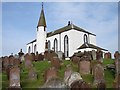
Crossmichael Church & graveyard
Crossmichael Parish Church (1749-51) with its centrally sited round tower and C19 conical roof paired with Balmaghie (opposite side of Loch Ken). The Churchyard has an fine enriched Gordon monument (1757), a Covenanter’s gravestone and three war graves. A table stone has an acrostic epitaph to Rev Andrew Dick.
Image: © Chris Newman
Taken: 3 Sep 2005
0.07 miles
7
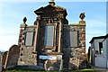
Memorial at Crossmichael Parish Church
Image: © Billy McCrorie
Taken: 11 Mar 2014
0.08 miles
8
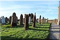
Graveyard at Crossmichael Parish Church
Image: © Billy McCrorie
Taken: 11 Mar 2014
0.08 miles
9

Crossmichael Parish Church and part of its burial ground
Viewed from the west
Image: © Peter Wood
Taken: 1 May 2026
0.08 miles
10

Crossmichael Station House
Looking southward along the track bed, up platform and station buildings at Crossmichael Station on the former 'Port Line' (Stranraer-Dumfries) 1861-1965. The house and buildings are now a private residence.
Image: © Chris Newman
Taken: 12 Jun 2008
0.08 miles