IMAGES TAKEN NEAR TO
Riverside Lane, CASTLE DOUGLAS, DG7 3AD
Introduction
This page details the photographs taken nearby to Riverside Lane, DG7 3AD by members of the Geograph project.
The Geograph project started in 2005 with the aim of publishing, organising and preserving representative images for every square kilometre of Great Britain, Ireland and the Isle of Man.

There are currently over 7.5m images from over14,400 individuals and you can help contribute to the project by visiting https://www.geograph.org.uk
Image Map
Images are licensed for reuse under creativecommons.org/licenses/by-sa/2.0
Notes
- Clicking on the map will re-center to the selected point.
- The higher the marker number, the further away the image location is from the centre of the postcode.
Image Listing (54 Images Found)
Images are licensed for reuse under creativecommons.org/licenses/by-sa/2.0
Image
Details
Distance
1
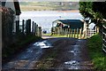
Crossmichael Marina
The hut on the right flying the flag is the Marina.
You can just make out Balmaghie church in the background across the loch. You can also just see the bull by the gate tucking into his winter feed (see supplemental image!)
Image: © Debbie Turner
Taken: 6 Jan 2008
0.02 miles
2
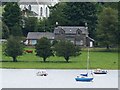
Old Railway Station, Crossmichael
Set on the shore of Loch Ken. Image taken from Balmaghie Churchyard. Crossmichael Church shown in background.
Image: © James Bell
Taken: 10 Aug 2010
0.04 miles
3
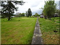
Crossmichael railway station (site), Dumfries & Galloway
Opened in 1861 by the Portpatrick Railway on what later became the Portpatrick & Wigtownshire Joint Railway from Castle Douglas to Portpatrick, this station closed in 1965. The railway line was known as 'The Port Road'.
View north west from the end of one of the platforms, towards Parton and Portpatrick. Compared to Image, the old signal box has been removed and a few more trees have grown up.
Image: © Nigel Thompson
Taken: 7 May 2019
0.04 miles
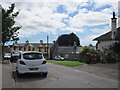
5
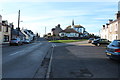
Main Street, Crossmichael
With the Parish Church on the right.
Image: © Billy McCrorie
Taken: 11 Mar 2014
0.05 miles
8
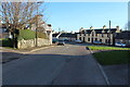
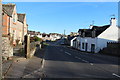
Approaching Crossmichael Main Street
Image: © Billy McCrorie
Taken: 11 Mar 2014
0.06 miles
9
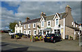
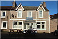
Main Street, Crossmichael
The Thistle Inn is part of this block of buildings on the Main Street.
Image: © Mary and Angus Hogg
Taken: 19 Sep 2016
0.06 miles