
IMAGES TAKEN NEAR TO
Kelton, CASTLE DOUGLAS, DG7 1SY
Introduction
This page details the photographs taken nearby to DG7 1SY by members of the Geograph project.
The Geograph project started in 2005 with the aim of publishing, organising and preserving representative images for every square kilometre of Great Britain, Ireland and the Isle of Man.

There are currently over 7.5m images from over14,400 individuals and you can help contribute to the project by visiting https://www.geograph.org.uk
Image Map
Images are licensed for reuse under creativecommons.org/licenses/by-sa/2.0
Notes
- Clicking on the map will re-center to the selected point.
- The higher the marker number, the further away the image location is from the centre of the postcode.
Image Listing (11 Images Found)
Images are licensed for reuse under creativecommons.org/licenses/by-sa/2.0
Image
Details
Distance

2

Mucking About
Even on a Queen's Diamond Jubilee Holiday fields have to be tended. I missed the tractor as I was walking up the road to Rhonehouse and decided to wait until he returned back up the field. The warm weather on the day made the smell of the muck quite a challenge to overcome and wait out for the picture. The things you do for Geograph.
Image: © Andy Farrington
Taken: 4 Jun 2012
0.18 miles
3

South of Slagnaw
Looking along the road to Rhonehouse.
Image: © Andy Farrington
Taken: 4 Jun 2012
0.18 miles
4

South of Slagnaw
Looking east over grazing land.
Image: © Andy Farrington
Taken: 4 Jun 2012
0.19 miles
5

Derelict Wind Pump
This pump marked on OS Mapping looks as though it hasn't worked for some time.
Image: © Andy Farrington
Taken: 4 Jun 2012
0.20 miles
6

Wind Pump
Marked up on OS Mapping this wind pump south of Slagnaw appears pretty derelict and out of action.
Image: © Andy Farrington
Taken: 4 Jun 2012
0.20 miles
7

Fields south of Slagnaw
Looking towards Gelston.
Image: © Andy Farrington
Taken: 4 Jun 2012
0.20 miles

9
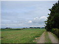
Slack Burn
Farm track connects the large open and harvested fields to west of Craigley Farm, Gelston.
Image: © Chris Newman
Taken: 8 Jun 2008
0.24 miles
10

South of Slagnaw
Looking along the road down to the B727.
Image: © Andy Farrington
Taken: 4 Jun 2012
0.24 miles