IMAGES TAKEN NEAR TO
Kelton, CASTLE DOUGLAS, DG7 1SF
Introduction
This page details the photographs taken nearby to DG7 1SF by members of the Geograph project.
The Geograph project started in 2005 with the aim of publishing, organising and preserving representative images for every square kilometre of Great Britain, Ireland and the Isle of Man.

There are currently over 7.5m images from over14,400 individuals and you can help contribute to the project by visiting https://www.geograph.org.uk
Image Map (Loading...)


Getting Data...Please wait
Leaflet Map data © OpenStreetMap
Images are licensed for reuse under creativecommons.org/licenses/by-sa/2.0
Notes
- Clicking on the map will re-center to the selected point.
- The higher the marker number, the further away the image location is from the centre of the postcode.
Image Listing (9 Images Found)
Images are licensed for reuse under creativecommons.org/licenses/by-sa/2.0
Image
Details
Distance
1
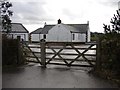
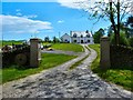
Longsheds
Longsheds Farm is situated between Mid Kelton and Rhonehouse near Castle Douglas.
Image: © Chris Newman
Taken: 2 Feb 2008
0.03 miles
2
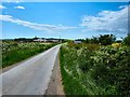
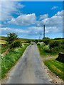
Road to Rhonehouse
Looking past Longsheds Equestrian Centre left of picture.
Image: © Andy Farrington
Taken: 4 Jun 2012
0.04 miles
3
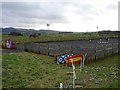
Longsheds Equestrian Training Centre
Longsheds equestrian training centre is situated between Mid Kelton and Rhonehouse near Castle Douglas. The Solway Hills can be seen in the distance.
Image: © Chris Newman
Taken: 2 Feb 2008
0.06 miles
4
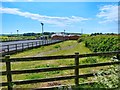
Longsheds Equestrian Centre
On the road to Mid Kelton.
Image: © Andy Farrington
Taken: 4 Jun 2012
0.08 miles
5

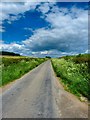
Road to Rhonehouse
Looking along the road towards Longsheds.
Image: © Andy Farrington
Taken: 4 Jun 2012
0.16 miles
6
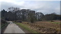
Road to Mid Kelton
Taken from Slackburn Bridge.
Image: © Andy Farrington
Taken: 4 Jun 2012
0.17 miles
7
Minor road near Kelton Hill
The minor road leading away from Rhonehouse to the south east.
Image: © Peter Mackenzie
Taken: 11 Apr 2018
0.18 miles
8
By Longsheds
The road to Mid Kelton.
Image: © Andy Farrington
Taken: 4 Jun 2012
0.22 miles
9
Slackburn Bridge
Dwelling by the bridge and burn.
Image: © Andy Farrington
Taken: 4 Jun 2012
0.25 miles