IMAGES TAKEN NEAR TO
Kirkennan View, CASTLE DOUGLAS, DG7 1PR
Introduction
This page details the photographs taken nearby to Kirkennan View, DG7 1PR by members of the Geograph project.
The Geograph project started in 2005 with the aim of publishing, organising and preserving representative images for every square kilometre of Great Britain, Ireland and the Isle of Man.

There are currently over 7.5m images from over14,400 individuals and you can help contribute to the project by visiting https://www.geograph.org.uk
Image Map (Loading...)


Getting Data...Please wait
Leaflet Map data © OpenStreetMap
Images are licensed for reuse under creativecommons.org/licenses/by-sa/2.0
Notes
- Clicking on the map will re-center to the selected point.
- The higher the marker number, the further away the image location is from the centre of the postcode.
Image Listing (103 Images Found)
Images are licensed for reuse under creativecommons.org/licenses/by-sa/2.0
Image
Details
Distance
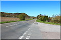
2
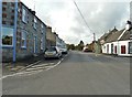
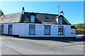
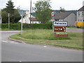
Port Road, Palnackie, looking southwest
Glenisle Inn can be seen on the right.
Image: © Ann Cook
Taken: 1 Oct 2012
0.04 miles
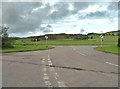
9
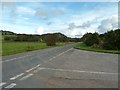
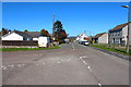
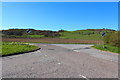
Tyre tracks on the A711
Lorries, turning to a nearby building site, have left this pattern on the A711 at its junction with the road into Palnackie.
Image: © Ann Cook
Taken: 1 Oct 2012
0.05 miles