IMAGES TAKEN NEAR TO
Colvend, DALBEATTIE, DG5 4QW
Introduction
This page details the photographs taken nearby to DG5 4QW by members of the Geograph project.
The Geograph project started in 2005 with the aim of publishing, organising and preserving representative images for every square kilometre of Great Britain, Ireland and the Isle of Man.

There are currently over 7.5m images from over14,400 individuals and you can help contribute to the project by visiting https://www.geograph.org.uk
Image Map
Images are licensed for reuse under creativecommons.org/licenses/by-sa/2.0
Notes
- Clicking on the map will re-center to the selected point.
- The higher the marker number, the further away the image location is from the centre of the postcode.
Image Listing (41 Images Found)
Images are licensed for reuse under creativecommons.org/licenses/by-sa/2.0
Image
Details
Distance
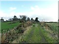
1
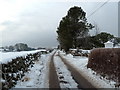
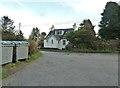
Snowy lane from Auchensheen (Dumfries)
Looking towards the A710 with Clonyard Farm to the left.
Image: © Anthony O'Neil
Taken: 26 Dec 2010
0.02 miles
2
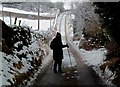
A Winter's Journey
Dumfries & Galloway
Image: © Anthony O'Neil
Taken: 26 Dec 2010
0.03 miles
3
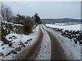
Laneway off A710 near Rock Cottage, Colvend
The southern portion of Dalbeattie forest is seen in the distance and stretches some six miles north west from here to the town of Dalbeattie.
Image: © Anthony O'Neil
Taken: 26 Dec 2010
0.05 miles
4
Cottage near Doonvale Farm, Ernsheenie, Dumfries
From the lane leading to the A710
Image: © Anthony O'Neil
Taken: 26 Dec 2010
0.06 miles
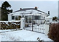
5
Rock Cottage
This view [looking across the A710] is taken from the beginning of the track to Mark Hill. This is the collection area for the rubbish for local homes.
Image: © Ann Cook
Taken: 6 Oct 2011
0.06 miles
6
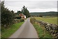
Minor road to Auchensheen
There are several houses along this road, which runs past Doonvale Farm to Auchensheen and Loch House Bank.
Image: © Richard Sutcliffe
Taken: 12 Oct 2016
0.06 miles
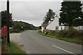
8
Passing Rock Cottage on the A710
The turning, on the right, is a track which leads through the forests to Rockcliffe and Kippford.
Image: © Ann Cook
Taken: 25 May 2011
0.06 miles
9
Looking towards the A710
Part of Rock Cottage can just be seen to the left of the car.
Image: © Ann Cook
Taken: 6 Oct 2011
0.07 miles
10
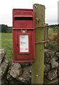
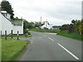
Postbox beside the A710
Diagonally opposite Rock Cottage. Postbox number DG5 56.
Image: © Richard Sutcliffe
Taken: 12 Oct 2016
0.07 miles