IMAGES TAKEN NEAR TO
Sandyhills, DALBEATTIE, DG5 4PT
Introduction
This page details the photographs taken nearby to DG5 4PT by members of the Geograph project.
The Geograph project started in 2005 with the aim of publishing, organising and preserving representative images for every square kilometre of Great Britain, Ireland and the Isle of Man.

There are currently over 7.5m images from over14,400 individuals and you can help contribute to the project by visiting https://www.geograph.org.uk
Image Map
Images are licensed for reuse under creativecommons.org/licenses/by-sa/2.0
Notes
- Clicking on the map will re-center to the selected point.
- The higher the marker number, the further away the image location is from the centre of the postcode.
Image Listing (101 Images Found)
Images are licensed for reuse under creativecommons.org/licenses/by-sa/2.0
Image
Details
Distance
1
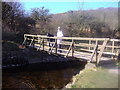
Bridge over the Barnhourie Burn
This bridge carries the path from Sandyhills Bay to the Saltpan Rocks.
Image: © Ann Cook
Taken: 10 Apr 2006
0.05 miles
2
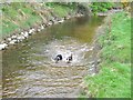
Barnhourie Burn
This is just before the burn meets the sea.
Image: © Ann Cook
Taken: 9 May 2010
0.05 miles
4
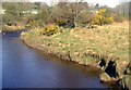
Barnhourie Burn
This is the Barnhourie Burn as it nears the sea. Sandyhills Bay Caravan Park can be seen in the distance.
Image: © Ann Cook
Taken: 10 Apr 2006
0.06 miles
5
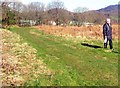
Grassy track
This track leads from the beach near Saltpan Rocks, behind the caravan park and to the A710. It is used by the 4x4 vehicles of the men who keep the stake nets.
Image: © Ann Cook
Taken: 10 Apr 2006
0.06 miles
6
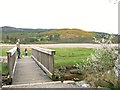
Bridge over the Barnhourie Burn
The tide is out, exposing the sands of Sandyhill Bay.
Image: © Ann Cook
Taken: 9 May 2010
0.07 miles
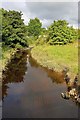
8
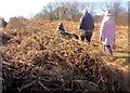
Walking through the bracken
This path through the bracken goes from Sandyhills Bay to the beach.
Image: © Ann Cook
Taken: 10 Apr 2006
0.08 miles
9
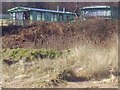
Scrubland between Sandyhills Caravan Park and the beach
Although it doesn't look it, this scrubland is thick and steep preventing access from the caravan site to the beach. It acts as a very good protective barrier keeping unwanted animals off the site.
Image: © Ann Cook
Taken: 10 Apr 2006
0.09 miles