IMAGES TAKEN NEAR TO
New Road, DALBEATTIE, DG5 4FG
Introduction
This page details the photographs taken nearby to New Road, DG5 4FG by members of the Geograph project.
The Geograph project started in 2005 with the aim of publishing, organising and preserving representative images for every square kilometre of Great Britain, Ireland and the Isle of Man.

There are currently over 7.5m images from over14,400 individuals and you can help contribute to the project by visiting https://www.geograph.org.uk
Image Map
Images are licensed for reuse under creativecommons.org/licenses/by-sa/2.0
Notes
- Clicking on the map will re-center to the selected point.
- The higher the marker number, the further away the image location is from the centre of the postcode.
Image Listing (300 Images Found)
Images are licensed for reuse under creativecommons.org/licenses/by-sa/2.0
Image
Details
Distance
1
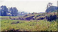
Site of Dalbeattie station
View eastward, towards Dumfries, on the edge of town. This had been a relatively important station on the ex-Glasgow & South Western Dumfries - Castle Douglas section of the (Carlisle) - Dumfries - Castle Douglas - Newton Stewart - Stranraer main line, which was closed completely on 14/6/65 and the trains to Stranraer (for Larne, Northern Ireland) diverted all the way round via Mauchline and Ayr; a whole swathe of SW Scotland was left without any railway.
Image: © Ben Brooksbank
Taken: 2 Sep 1991
0.05 miles
2
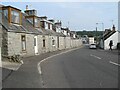
Cottages, Maxwell Street
A fine terrace of cottages in the local granite vernacular.
Image: © Jonathan Wilkins
Taken: 5 Sep 2021
0.07 miles
3
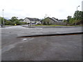
Dalbeattie railway station (site), Dumfries & Galloway
Opened in 1859 by the Castle Douglas & Dumfries Railway, later part of the Glasgow & South Western Railway, this station closed in 1965. The railway line was known as 'The Port Road'.
View west on the track-bed, from near the ends of the platforms, towards Buittle and Castle Douglas. This site has since been redeveloped as a small housing estate.
Image: © Nigel Thompson
Taken: 7 May 2019
0.08 miles
9
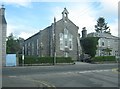
Former Free Church
This building stands at 5 John Street and is a listed building. It is a former United Free Church and is now the Colliston Boys' Club Hall.
Image: © Ann Cook
Taken: 27 May 2011
0.10 miles