IMAGES TAKEN NEAR TO
Durisdeer, THORNHILL, DG3 5BW
Introduction
This page details the photographs taken nearby to DG3 5BW by members of the Geograph project.
The Geograph project started in 2005 with the aim of publishing, organising and preserving representative images for every square kilometre of Great Britain, Ireland and the Isle of Man.

There are currently over 7.5m images from over14,400 individuals and you can help contribute to the project by visiting https://www.geograph.org.uk
Image Map (Loading...)


Getting Data...Please wait
Leaflet Map data © OpenStreetMap
Images are licensed for reuse under creativecommons.org/licenses/by-sa/2.0
Notes
- Clicking on the map will re-center to the selected point.
- The higher the marker number, the further away the image location is from the centre of the postcode.
Image Listing (2 Images Found)
Images are licensed for reuse under creativecommons.org/licenses/by-sa/2.0
Image
Details
Distance
1
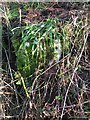
Old Milestone by the A702, Muircleuch, Durisdeer Parish
By the A702, in parish of Durisdeer (Nithsdale District), Muircleuch, just North of woods.
Inscription once read:- : (21) : (To Dumfries)
Surveyed
Milestone Society National ID: DG_DFEF21
Image: © Milestone Society
Taken: Unknown
0.23 miles
2
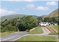
Cyclist passing entrance to Muircleuch
At the southern end of the Dalveen Pass, with the Lowther Hills in the background.
Image: © Alan O'Dowd
Taken: 26 Jul 2018
0.25 miles