IMAGES TAKEN NEAR TO
Crocketford, DUMFRIES, DG2 8QE
Introduction
This page details the photographs taken nearby to DG2 8QE by members of the Geograph project.
The Geograph project started in 2005 with the aim of publishing, organising and preserving representative images for every square kilometre of Great Britain, Ireland and the Isle of Man.

There are currently over 7.5m images from over14,400 individuals and you can help contribute to the project by visiting https://www.geograph.org.uk
Image Map
Images are licensed for reuse under creativecommons.org/licenses/by-sa/2.0
Notes
- Clicking on the map will re-center to the selected point.
- The higher the marker number, the further away the image location is from the centre of the postcode.
Image Listing (12 Images Found)
Images are licensed for reuse under creativecommons.org/licenses/by-sa/2.0
Image
Details
Distance
1
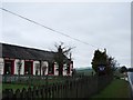
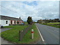
East Brae Cottage Bed and Breakfast
Handy for the A75.
Image: © Ian Paterson
Taken: 15 Mar 2008
0.12 miles
2
Brae Cottages
First cottage on the left is West Brae, then East Brae which is a B&B, with a view along the A75.
Image: © Andy Farrington
Taken: 3 Apr 2012
0.13 miles
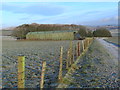
4
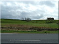
Brae Cottages
View over to Bettyknowes Hill.
Image: © Andy Farrington
Taken: 3 Apr 2012
0.14 miles
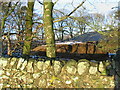
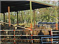
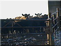
6
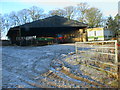
Straw bales under cover in frozen farmyard
Image: © ian shiell
Taken: 7 Dec 2008
0.16 miles
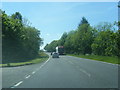
7
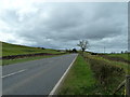
Brae Cottages
Looking along the A75 towards Crocketford.
Image: © Andy Farrington
Taken: 3 Apr 2012
0.16 miles