
IMAGES TAKEN NEAR TO
Lochfoot, DUMFRIES, DG2 8NU
Introduction
This page details the photographs taken nearby to DG2 8NU by members of the Geograph project.
The Geograph project started in 2005 with the aim of publishing, organising and preserving representative images for every square kilometre of Great Britain, Ireland and the Isle of Man.

There are currently over 7.5m images from over14,400 individuals and you can help contribute to the project by visiting https://www.geograph.org.uk
Image Map
Images are licensed for reuse under creativecommons.org/licenses/by-sa/2.0
Notes
- Clicking on the map will re-center to the selected point.
- The higher the marker number, the further away the image location is from the centre of the postcode.
Image Listing (7 Images Found)
Images are licensed for reuse under creativecommons.org/licenses/by-sa/2.0
Image
Details
Distance
1
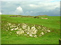
Rock Outcrop and Wall on Barnbackle Hill
Image: © Iain Thompson
Taken: 20 Oct 2006
0.04 miles
2
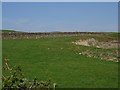
Barnbackle Hill
Beside the Old Military Road.
Image: © Richard Webb
Taken: 22 Apr 2019
0.05 miles
3
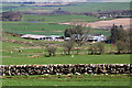
Whiteyard Farm
The farm was viewed from a grazing field on Barnbackle Hill.
Image: © Walter Baxter
Taken: 20 Apr 2018
0.18 miles
5
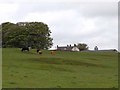
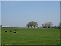
Slacks Farm
The roof of Slacks Farm can just be seen from the Old Military Road.
Image: © Oliver Dixon
Taken: 23 May 2009
0.19 miles
6
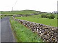
Old Military Road below Barnbackle Hill
There seems to be some disagreement about the origin of the Old Military Road which ran from Dumfries to Portpatrick, the port for Ireland in the 16th and 17th centuries (Stranraer is a modern port). One source states that construction was instigated by James VI to facilitate the "Plantation" of Ulster, another source states that it was built by Cromwell's army. Although the road is traceable (just) over most of its length, it is only between Dumfries and Castle Douglas that it survives as a continuous stretch of modern road. This section is followed by National Cycle Network route 7.
Image: © Oliver Dixon
Taken: 23 May 2009
0.19 miles
7
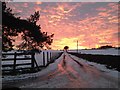
Way to Whiteyard
Drive up to Whiteyard Farm.
Image: © Debbie Turner
Taken: 6 Feb 2015
0.25 miles