IMAGES TAKEN NEAR TO
Loaning Foot, DUMFRIES, DG2 8AX
Introduction
This page details the photographs taken nearby to Loaning Foot, DG2 8AX by members of the Geograph project.
The Geograph project started in 2005 with the aim of publishing, organising and preserving representative images for every square kilometre of Great Britain, Ireland and the Isle of Man.

There are currently over 7.5m images from over14,400 individuals and you can help contribute to the project by visiting https://www.geograph.org.uk
Image Map
Images are licensed for reuse under creativecommons.org/licenses/by-sa/2.0
Notes
- Clicking on the map will re-center to the selected point.
- The higher the marker number, the further away the image location is from the centre of the postcode.
Image Listing (19 Images Found)
Images are licensed for reuse under creativecommons.org/licenses/by-sa/2.0
Image
Details
Distance
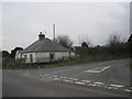
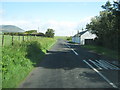
1
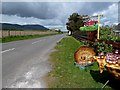
The road at Loaningfoot
I stopped by the roadside at this sign and bought some wonderful home-made jam, rolls and bread from a lady in a house on the east side of the road.
Image: © Walter Baxter
Taken: 12 May 2012
0.01 miles
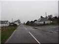
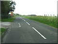
4
Cottages in Loaningfoot
Loaningfoot isn't very big!
Image: © Ann Cook
Taken: 24 May 2011
0.04 miles
6
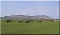
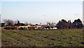
Cattle at Loaningfoot
Criffel is the highest hill in the background to the right.
Image: © Walter Baxter
Taken: 31 Mar 2007
0.05 miles
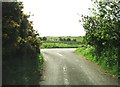
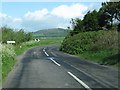
7
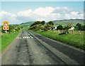
Approaching a right-hand bend at Loaningfoot
Image: © Ann Cook
Taken: 24 May 2011
0.07 miles