IMAGES TAKEN NEAR TO
Kirkbean, DUMFRIES, DG2 8AD
Introduction
This page details the photographs taken nearby to DG2 8AD by members of the Geograph project.
The Geograph project started in 2005 with the aim of publishing, organising and preserving representative images for every square kilometre of Great Britain, Ireland and the Isle of Man.

There are currently over 7.5m images from over14,400 individuals and you can help contribute to the project by visiting https://www.geograph.org.uk
Image Map
Images are licensed for reuse under creativecommons.org/licenses/by-sa/2.0
Notes
- Clicking on the map will re-center to the selected point.
- The higher the marker number, the further away the image location is from the centre of the postcode.
Image Listing (16 Images Found)
Images are licensed for reuse under creativecommons.org/licenses/by-sa/2.0
Image
Details
Distance
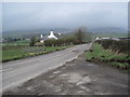
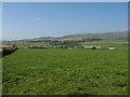
3
Entrance to Newmains
The Criffel is in the distance.
Image: © Ann Cook
Taken: 24 May 2011
0.05 miles
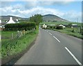
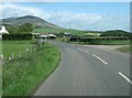
4
Newmains Cottages and road toward A710
Image: © Martin Dawes
Taken: 30 May 2014
0.05 miles
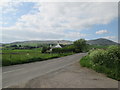
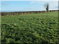
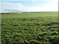
5
Grazing land near to Newmains
Extensive grazing fields succeed the arable land as one moves inland. Cows are plentiful and the land tells of their importance.
Image: © Jonathan Wilkins
Taken: 7 Sep 2021
0.08 miles
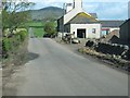
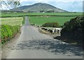
6
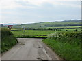
Minor road T Junction
Turn left to Southerness, right for the A710. The road surface requires TLC.
Image: © Martin Dawes
Taken: 30 May 2014
0.09 miles
7
Turning to John Paul Cottage and Arbigland
Newmains Cottages can just be seen on the left. The Criffel is in the distance.
Image: © Ann Cook
Taken: 24 May 2011
0.09 miles
8
Tree along the road to Arbigland
South of Newmains, off the road to Southerness.
Image: © Christine Johnstone
Taken: 22 Jan 2020
0.11 miles
9
Farmland south of Newmains
About 30 metres above sea level.
Image: © Christine Johnstone
Taken: 22 Jan 2020
0.14 miles
10
Approaching a bridge over Prestonmill Burn
Image: © Ann Cook
Taken: 24 May 2011
0.14 miles