IMAGES TAKEN NEAR TO
Robison Drive, DUMFRIES, DG2 7RW
Introduction
This page details the photographs taken nearby to Robison Drive, DG2 7RW by members of the Geograph project.
The Geograph project started in 2005 with the aim of publishing, organising and preserving representative images for every square kilometre of Great Britain, Ireland and the Isle of Man.

There are currently over 7.5m images from over14,400 individuals and you can help contribute to the project by visiting https://www.geograph.org.uk
Image Map
Images are licensed for reuse under creativecommons.org/licenses/by-sa/2.0
Notes
- Clicking on the map will re-center to the selected point.
- The higher the marker number, the further away the image location is from the centre of the postcode.
Image Listing (53 Images Found)
Images are licensed for reuse under creativecommons.org/licenses/by-sa/2.0
Image
Details
Distance
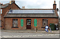
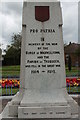
1
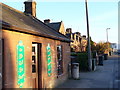
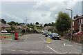
Old Toll House, Maxwelltown
Looking south along New Abbey Road. The toll house is now a shop. It and the houses on this stretch of road are built of local red sandstone.
Image: © Colin Smith
Taken: 4 Apr 2007
0.11 miles
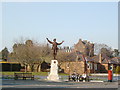
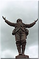
6
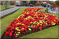
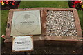
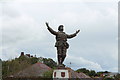
Flower Garden at War Memorial, Dumfries
Image: © Billy McCrorie
Taken: 8 Aug 2017
0.12 miles