IMAGES TAKEN NEAR TO
Ewart Walk, DUMFRIES, DG2 7HE
Introduction
This page details the photographs taken nearby to Ewart Walk, DG2 7HE by members of the Geograph project.
The Geograph project started in 2005 with the aim of publishing, organising and preserving representative images for every square kilometre of Great Britain, Ireland and the Isle of Man.

There are currently over 7.5m images from over14,400 individuals and you can help contribute to the project by visiting https://www.geograph.org.uk
Image Map
Images are licensed for reuse under creativecommons.org/licenses/by-sa/2.0
Notes
- Clicking on the map will re-center to the selected point.
- The higher the marker number, the further away the image location is from the centre of the postcode.
Image Listing (76 Images Found)
Images are licensed for reuse under creativecommons.org/licenses/by-sa/2.0
Image
Details
Distance
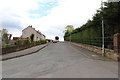
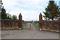
2
East Riverview
Over the Kirkpatrick Macmillan to Troqueer
Image: © Hugh Close
Taken: 29 Dec 2013
0.06 miles
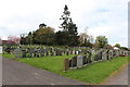
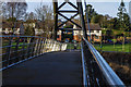
10
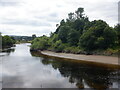
River Nith
The upper reaches of the tidal river, seen from beside the Kirkpatrick MacMillan Bridge.
Image: © Richard Webb
Taken: 30 Jul 2024
0.08 miles