IMAGES TAKEN NEAR TO
Dunscore, DUMFRIES, DG2 0XA
Introduction
This page details the photographs taken nearby to DG2 0XA by members of the Geograph project.
The Geograph project started in 2005 with the aim of publishing, organising and preserving representative images for every square kilometre of Great Britain, Ireland and the Isle of Man.

There are currently over 7.5m images from over14,400 individuals and you can help contribute to the project by visiting https://www.geograph.org.uk
Image Map
Images are licensed for reuse under creativecommons.org/licenses/by-sa/2.0
Notes
- Clicking on the map will re-center to the selected point.
- The higher the marker number, the further away the image location is from the centre of the postcode.
Image Listing (9 Images Found)
Images are licensed for reuse under creativecommons.org/licenses/by-sa/2.0
Image
Details
Distance
1
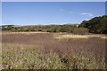
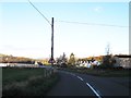
Wetland near Coatston
A marsh and reedbed between an embankment which carried the Glencairn Light Railway and a minor road.
Image: © Richard Webb
Taken: 6 Oct 2018
0.16 miles
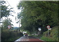
3
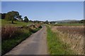
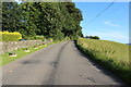
Yellow road, Coatston
The western side of the Cairn Water with a marsh on the left.
Image: © Richard Webb
Taken: 6 Oct 2018
0.17 miles