IMAGES TAKEN NEAR TO
Kirkgate, DUMFRIES, DG2 0SZ
Introduction
This page details the photographs taken nearby to Kirkgate, DG2 0SZ by members of the Geograph project.
The Geograph project started in 2005 with the aim of publishing, organising and preserving representative images for every square kilometre of Great Britain, Ireland and the Isle of Man.

There are currently over 7.5m images from over14,400 individuals and you can help contribute to the project by visiting https://www.geograph.org.uk
Image Map
Images are licensed for reuse under creativecommons.org/licenses/by-sa/2.0
Notes
- Clicking on the map will re-center to the selected point.
- The higher the marker number, the further away the image location is from the centre of the postcode.
Image Listing (50 Images Found)
Images are licensed for reuse under creativecommons.org/licenses/by-sa/2.0
Image
Details
Distance
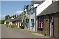
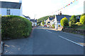
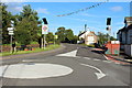
6
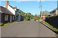
Dunscore, Dumfriesshire
View from the south.
Image: © Richard Webb
Taken: 3 Sep 2015
0.02 miles
7
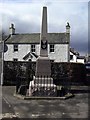
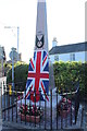
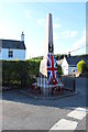
Dunscore war memorial
The war memorial in Dunscore.
Image: © Colin Kinnear
Taken: 5 Mar 2008
0.03 miles
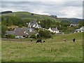
10
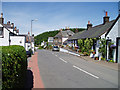
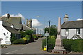
Dunscore
This picturesque small village lies between Moniaive and Dumfries.
Image: © Kevin Rae
Taken: 3 Jun 2006
0.03 miles