IMAGES TAKEN NEAR TO
Auldgirth, DUMFRIES, DG2 0SA
Introduction
This page details the photographs taken nearby to DG2 0SA by members of the Geograph project.
The Geograph project started in 2005 with the aim of publishing, organising and preserving representative images for every square kilometre of Great Britain, Ireland and the Isle of Man.

There are currently over 7.5m images from over14,400 individuals and you can help contribute to the project by visiting https://www.geograph.org.uk
Image Map
Images are licensed for reuse under creativecommons.org/licenses/by-sa/2.0
Notes
- Clicking on the map will re-center to the selected point.
- The higher the marker number, the further away the image location is from the centre of the postcode.
Image Listing (13 Images Found)
Images are licensed for reuse under creativecommons.org/licenses/by-sa/2.0
Image
Details
Distance
2
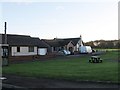
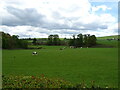
A76 at South Lodge
Entrance to Friars Carse
Image: © John Firth
Taken: 19 May 2013
0.03 miles
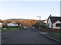
5
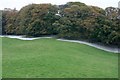
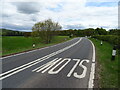
Woodland South of Auldgirth
White sheets have been laid below the canopy presumably to gather the nuts. Hazel or acorns?
Image: © Mick Garratt
Taken: 25 Oct 2007
0.18 miles
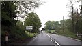
6
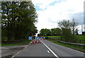
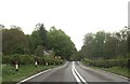
Roadworks on the A76 near Carse Mains
Towards Dumfries.
Image: © JThomas
Taken: 22 May 2021
0.19 miles
9
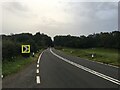
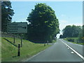
Warning for junction for Burnhead
At Penflowing Bridge
Image: © John Firth
Taken: 19 May 2013
0.19 miles