IMAGES TAKEN NEAR TO
Undercraigs Road, DUMFRIES, DG1 4YA
Introduction
This page details the photographs taken nearby to Undercraigs Road, DG1 4YA by members of the Geograph project.
The Geograph project started in 2005 with the aim of publishing, organising and preserving representative images for every square kilometre of Great Britain, Ireland and the Isle of Man.

There are currently over 7.5m images from over14,400 individuals and you can help contribute to the project by visiting https://www.geograph.org.uk
Image Map
Images are licensed for reuse under creativecommons.org/licenses/by-sa/2.0
Notes
- Clicking on the map will re-center to the selected point.
- The higher the marker number, the further away the image location is from the centre of the postcode.
Image Listing (8 Images Found)
Images are licensed for reuse under creativecommons.org/licenses/by-sa/2.0
Image
Details
Distance
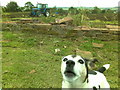
2
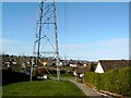
A place to walk the dog, Georgetown in Dumfries
Image: © Darrin Antrobus
Taken: 4 Mar 2008
0.15 miles
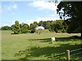
3
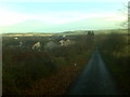
Lane leading to Under Craigs farmhouse
Georgetown, Dumfries
Image: © Dumgoyach
Taken: 15 Nov 2006
0.17 miles
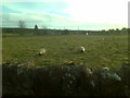
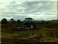
5
Tractor in a field, dog in the foreground
Image: © Darrin Antrobus
Taken: 28 Sep 2007
0.20 miles
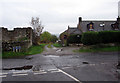
8
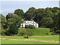
Craig Lodge
Country house just outside Georgetown,Dumfries.
Image: © Oliver Dixon
Taken: 2 Sep 2013
0.22 miles