
IMAGES TAKEN NEAR TO
Queensberry View, Craigs Road, DUMFRIES, DG1 4UR
Introduction
This page details the photographs taken nearby to Queensberry View, Craigs Road, DG1 4UR by members of the Geograph project.
The Geograph project started in 2005 with the aim of publishing, organising and preserving representative images for every square kilometre of Great Britain, Ireland and the Isle of Man.

There are currently over 7.5m images from over14,400 individuals and you can help contribute to the project by visiting https://www.geograph.org.uk
Image Map
Images are licensed for reuse under creativecommons.org/licenses/by-sa/2.0
Notes
- Clicking on the map will re-center to the selected point.
- The higher the marker number, the further away the image location is from the centre of the postcode.
Image Listing (12 Images Found)
Images are licensed for reuse under creativecommons.org/licenses/by-sa/2.0
Image
Details
Distance
1
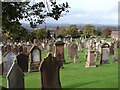
Dumfries Cemetery
View down NE side of Dumfries Cemetery. Beyond is Dumfries town.
Image: © Chris Newman
Taken: 1 Nov 2005
0.06 miles
2
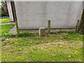
Boundary Stone, Graigs Road
Parliamentary & Police Burgh boundary in 1900.
Milestone Society National ID: DF_DUMF02pb
Image: © Wayne MacDonald
Taken: 12 Aug 2021
0.08 miles
3
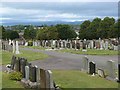
St Michael's Cemetery, Dumfries
Off Craig Road.
Image: © Oliver Dixon
Taken: 2 Sep 2013
0.08 miles
4
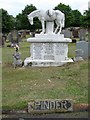
Pinder Grave, Dumfries
Pinder circus family grave in St Michael's Cemetery, Dumfries.
Image: © Chris Newman
Taken: 21 May 2008
0.12 miles
5
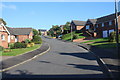
New housing, Dumfries
New housing in Calside, Dumfries.
Image: © Colin Kinnear
Taken: 11 Oct 2010
0.16 miles
6
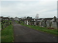
North end, St Andrew's Roman Catholic cemetery
The houses beyond are in Aspen Close.
Image: © Christine Johnstone
Taken: 23 Jan 2020
0.18 miles
7
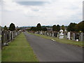
St Michael's Cemetery, Dumfries
St Michael's Cemetery (not to be confused with St Michael's Graveyard at the church) is a large cemetery to the north of Dumfries Cemetery. It contains 54 war graves and some notable gravestones, including the Pinter circus family grave (horse sculpture to right of central path) - see Image
Image: © Chris Newman
Taken: 21 May 2008
0.18 miles
8
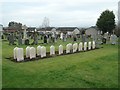
Commonwealth war graves, from the south
There are 33 Commonwealth war graves at St Andrew's Roman Catholic cemetery, Dumfries. Most [but not all] are airmen from World War Two, who trained with the 10th Observer Advanced Flying Unit. Many were Polish, a few Australian and one Czech. https://www.cwgc.org/find/find-war-dead/results/?cemetery=DUMFRIES+(ST.+ANDREW%27S)+ROMAN+CATHOLIC+CEMETERY&casualtypagenumber=1
Image: © Christine Johnstone
Taken: 23 Jan 2020
0.20 miles
9
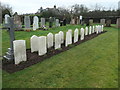
Commonwealth war graves, from the north
There are 33 Commonwealth war graves at St Andrew's Roman Catholic cemetery, Dumfries. Most [but not all] are airmen from World War Two, who trained with the 10th Observer Advanced Flying Unit. Many were Polish, a few Australian and one Czech. https://www.cwgc.org/find/find-war-dead/results/?cemetery=DUMFRIES+(ST.+ANDREW%27S)+ROMAN+CATHOLIC+CEMETERY&casualtypagenumber=1
Image: © Christine Johnstone
Taken: 23 Jan 2020
0.20 miles
10
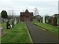
Chapel at St Andrew's Roman Catholic Cemetery
On Craigs Road, Dumfries. The cemetery contains 33 war graves, mostly from the Second World War - see https://www.cwgc.org/find/find-war-dead/results/?cemetery=DUMFRIES+(ST.+ANDREW%27S)+ROMAN+CATHOLIC+CEMETERY&casualtypagenumber=1
Image: © Christine Johnstone
Taken: 23 Jan 2020
0.21 miles