IMAGES TAKEN NEAR TO
Runic Place, DUMFRIES, DG1 4NW
Introduction
This page details the photographs taken nearby to Runic Place, DG1 4NW by members of the Geograph project.
The Geograph project started in 2005 with the aim of publishing, organising and preserving representative images for every square kilometre of Great Britain, Ireland and the Isle of Man.

There are currently over 7.5m images from over14,400 individuals and you can help contribute to the project by visiting https://www.geograph.org.uk
Image Map
Images are licensed for reuse under creativecommons.org/licenses/by-sa/2.0
Notes
- Clicking on the map will re-center to the selected point.
- The higher the marker number, the further away the image location is from the centre of the postcode.
Image Listing (18 Images Found)
Images are licensed for reuse under creativecommons.org/licenses/by-sa/2.0
Image
Details
Distance
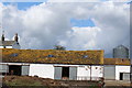
4
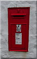
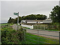
Victorian postbox, Ruthwell
Postbox No. DG1 121.
See Image] for context.
Image: © JThomas
Taken: 20 Nov 2019
0.09 miles
5
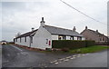
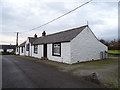
Cottage, Ruthwell
Showing position of Postbox No. DG1 121.
See Image] for postbox.
Image: © JThomas
Taken: 20 Nov 2019
0.10 miles
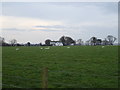
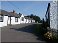
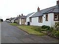
10
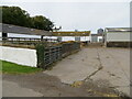
Farm yard and buildings at Thwaite
Looking north-westward.
Image: © Peter Wood
Taken: 29 Sep 2024
0.17 miles