IMAGES TAKEN NEAR TO
ANNAN, DG12 5PA
Introduction
This page details the photographs taken nearby to DG12 5PA by members of the Geograph project.
The Geograph project started in 2005 with the aim of publishing, organising and preserving representative images for every square kilometre of Great Britain, Ireland and the Isle of Man.

There are currently over 7.5m images from over14,400 individuals and you can help contribute to the project by visiting https://www.geograph.org.uk
Image Map (Loading...)


Getting Data...Please wait
Leaflet Map data © OpenStreetMap
Images are licensed for reuse under creativecommons.org/licenses/by-sa/2.0
Notes
- Clicking on the map will re-center to the selected point.
- The higher the marker number, the further away the image location is from the centre of the postcode.
Image Listing (7 Images Found)
Images are licensed for reuse under creativecommons.org/licenses/by-sa/2.0
Image
Details
Distance
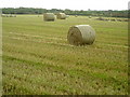
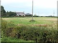
5
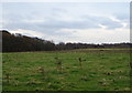
Grazing off the B724
Towards the Carlisle to Dumfries railway.
Image: © JThomas
Taken: 20 Nov 2019
0.13 miles
6
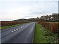
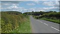
National Cycle Route 7
The B724 towards Annan.
Image: © JThomas
Taken: 20 Nov 2019
0.15 miles