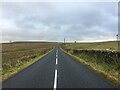
IMAGES TAKEN NEAR TO
Waterbeck, LOCKERBIE, DG11 3HE
Introduction
This page details the photographs taken nearby to DG11 3HE by members of the Geograph project.
The Geograph project started in 2005 with the aim of publishing, organising and preserving representative images for every square kilometre of Great Britain, Ireland and the Isle of Man.

There are currently over 7.5m images from over14,400 individuals and you can help contribute to the project by visiting https://www.geograph.org.uk
Image Map
Images are licensed for reuse under creativecommons.org/licenses/by-sa/2.0
Notes
- Clicking on the map will re-center to the selected point.
- The higher the marker number, the further away the image location is from the centre of the postcode.
Image Listing (9 Images Found)
Images are licensed for reuse under creativecommons.org/licenses/by-sa/2.0
Image
Details
Distance
1
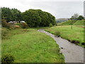
The Kirtle Water from Fallford Bridge
Looking upstream to Fallford Lodge.
Image: © M J Richardson
Taken: 2 Oct 2021
0.05 miles
3
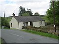
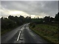
Former Tollhouse by the B7068 at Fallford
Fallford toll house by the B7068, in parish of (Dumfries and Galloway District), Toll House.
Surveyed
Milestone Society National ID: DG.FFD
Image: © Milestone Society
Taken: Unknown
0.09 miles
4
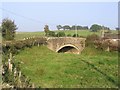
Fallford Bridge over the Kirtle Water
This bridge is at the junction of the B722 and B7068 near Kirtleton.
Image: © Walter Baxter
Taken: 15 Oct 2006
0.10 miles
5
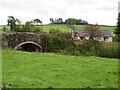
Fallford Bridge
The B7068 crosses the Kirtle Water by Barr Cottage.
Image: © M J Richardson
Taken: 2 Oct 2021
0.10 miles
6
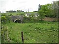
Former tollhouse
Surveyed by the Milestone Society. The bridge on the B7068 over the Kirtle Water with Fallford tollhouse at the far side. It was used by the Lockerbie to Langholm Trust
Image: © Alverie Weighill
Taken: 25 May 2015
0.10 miles
7
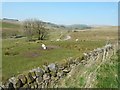
The track to Winterhope Reservoir
Seen from beside the B7068
Image: © John Baker
Taken: 28 Mar 2012
0.17 miles