
IMAGES TAKEN NEAR TO
Ecclefechan, LOCKERBIE, DG11 3ES
Introduction
This page details the photographs taken nearby to DG11 3ES by members of the Geograph project.
The Geograph project started in 2005 with the aim of publishing, organising and preserving representative images for every square kilometre of Great Britain, Ireland and the Isle of Man.

There are currently over 7.5m images from over14,400 individuals and you can help contribute to the project by visiting https://www.geograph.org.uk
Image Map
Images are licensed for reuse under creativecommons.org/licenses/by-sa/2.0
Notes
- Clicking on the map will re-center to the selected point.
- The higher the marker number, the further away the image location is from the centre of the postcode.
Image Listing (8 Images Found)
Images are licensed for reuse under creativecommons.org/licenses/by-sa/2.0
Image
Details
Distance
2
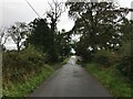
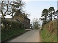
Road (B725) at Greengatehouse
Looking eastward.
Image: © Peter Wood
Taken: 20 Sep 2014
0.13 miles
3
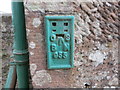
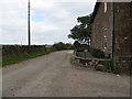
Ordnance Survey Flush Bracket G55
This can be found on the wall of Greengate House Farm
For more detail see : http://www.bench-marks.org.uk/bm695
Image: © Peter Wood
Taken: 20 Sep 2014
0.13 miles
4
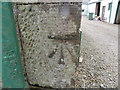
Ordnance Survey Cut Mark
This can be found on the farmhouse wall. An attempt has been made to cancel it by cementing over the cuts - presumably at the time the Flush Bracket was fixed just round the corner. The edge of the FB can be seen in the photograph.
For more detail see : http://www.bench-marks.org.uk/bm62245
Image: © Peter Wood
Taken: 20 Sep 2014
0.13 miles
6
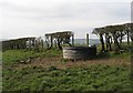
Drinking trough
Polypropylene drinking trough serving the prodigious thirsts of cattle.
Image: © Richard Webb
Taken: 31 Mar 2007
0.18 miles
7
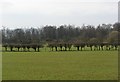
Grown out hedge.
A hedge that has not been relaid for many years. The bottom has grown out and it is now reinforced with wire fencing.
Image: © Richard Webb
Taken: 31 Mar 2007
0.21 miles
8
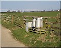
Stoneybeck road end.
The churns are decorative now, and the galvanising is wearing off, exposing the steel to corrosion. Until the early 1970's milk was transported this way. We left dairying at this time, as well as low prices, the cost of conversion to bulk carriers was a major factor. The churns were taken on a trailer a few hundred metres to a roadside stand and collected later, hopefully not too much later in summer.
Stoneybeck itself is about 800m up the lane in a neighbouring square. There are still many dairy units in operation in Dumfriesshire.
Image: © Richard Webb
Taken: 31 Mar 2007
0.21 miles