
IMAGES TAKEN NEAR TO
Middlebie, LOCKERBIE, DG11 3ER
Introduction
This page details the photographs taken nearby to DG11 3ER by members of the Geograph project.
The Geograph project started in 2005 with the aim of publishing, organising and preserving representative images for every square kilometre of Great Britain, Ireland and the Isle of Man.

There are currently over 7.5m images from over14,400 individuals and you can help contribute to the project by visiting https://www.geograph.org.uk
Image Map
Images are licensed for reuse under creativecommons.org/licenses/by-sa/2.0
Notes
- Clicking on the map will re-center to the selected point.
- The higher the marker number, the further away the image location is from the centre of the postcode.
Image Listing (2 Images Found)
Images are licensed for reuse under creativecommons.org/licenses/by-sa/2.0
Image
Details
Distance
1
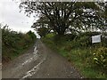
Farm road towards Scotsbrig and Darlawhill
Image: © Steven Brown
Taken: 22 Sep 2022
0.18 miles
2
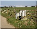
Stoneybeck road end.
The churns are decorative now, and the galvanising is wearing off, exposing the steel to corrosion. Until the early 1970's milk was transported this way. We left dairying at this time, as well as low prices, the cost of conversion to bulk carriers was a major factor. The churns were taken on a trailer a few hundred metres to a roadside stand and collected later, hopefully not too much later in summer.
Stoneybeck itself is about 800m up the lane in a neighbouring square. There are still many dairy units in operation in Dumfriesshire.
Image: © Richard Webb
Taken: 31 Mar 2007
0.21 miles