
IMAGES TAKEN NEAR TO
Burnholm Road, LOCKERBIE, DG11 3AY
Introduction
This page details the photographs taken nearby to Burnholm Road, DG11 3AY by members of the Geograph project.
The Geograph project started in 2005 with the aim of publishing, organising and preserving representative images for every square kilometre of Great Britain, Ireland and the Isle of Man.

There are currently over 7.5m images from over14,400 individuals and you can help contribute to the project by visiting https://www.geograph.org.uk
Image Map
Images are licensed for reuse under creativecommons.org/licenses/by-sa/2.0
Notes
- Clicking on the map will re-center to the selected point.
- The higher the marker number, the further away the image location is from the centre of the postcode.
Image Listing (32 Images Found)
Images are licensed for reuse under creativecommons.org/licenses/by-sa/2.0
Image
Details
Distance
1
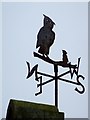
Weather vane, Kirkpatrick Fleming
The weather vane is on the school. Image
Weather vanes have always been more than just a wind direction device. Created by skilled craftsman, there is true artistic expression in the varied designs. Initially wood vanes were carved by carpenters or furniture makers, and iron, copper and tin ones were forged by the local blacksmith or tinsmith. In the 19th century weather vanes started to be mass-produced from moulds.
Because the Victorians were fond of ornament, by the 19th century, these silhouette weathervanes began to take on a wider range of subjects, from exotic animals, mythical creatures, sporting motifs, and even trade signs. Wrought iron finally gave way to the easily mass-produced cast iron vane. Unfortunately, this meant not only that the copper weathervane maker was becoming obsolete, but also that the unique character of the hand-made weathervane was being discarded for reasons of cost efficiency and repeatability.
Image: © Maigheach-gheal
Taken: 5 Apr 2010
0.02 miles
2

School, Kirkpatrick Fleming
The school is beside the B7076.
Image: © Maigheach-gheal
Taken: 5 Apr 2010
0.02 miles
3
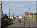
Road (B7076) through Kirkpatrick-Fleming
Looking north-westward.
Image: © Peter Wood
Taken: 27 Sep 2014
0.03 miles
4
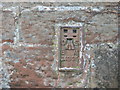
Ordnance Survey Flush Bracket G4399
This can be found on the wall of the school at Kirkpatrick-Fleming.
For more detail see : http://www.bench-marks.org.uk/bm12468
Image: © Peter Wood
Taken: 27 Sep 2014
0.03 miles
5
Bus shelter in Kirkpatrick Fleming
Image: © Jonathan Thacker
Taken: 21 Nov 2018
0.03 miles
6

Flush Bracket G4399, Kirkpatrick Fleming
The flush bracket is on the school. For a view of the school Image and information about the flush bracket http://www.bench-marks.org.uk/bm12468
A bench mark is an Ordnance Survey arrowhead sign found on walls, bridges, churches and specially erected triangulation pillars where the altitude above sea-level has been accurately measured by surveyors. The arrowhead points to a horizontal line above it which marks the exact altitude.
With rivets and pivots there is no datum (horizontal line) cut, the pointed-to horizontal surface defining the datum height.
Image: © Maigheach-gheal
Taken: 5 Apr 2010
0.04 miles
7
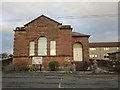
Victoria Hall, Kirkpatrick Fleming
Image: © Jonathan Thacker
Taken: 21 Nov 2018
0.05 miles
8
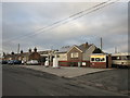
Filling station in Kirkpatrick Fleming
Image: © Jonathan Thacker
Taken: 21 Nov 2018
0.06 miles
9
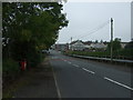
B7076 Roman Road, Kirkpatrick-Fleming
Looking north west.
Image: © JThomas
Taken: 3 Oct 2015
0.07 miles
10
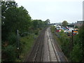
Dumfries to Carlisle railway at Kirkpatrick-Fleming
Looking west.
Image: © JThomas
Taken: 3 Oct 2015
0.08 miles