
IMAGES TAKEN NEAR TO
LOCKERBIE, DG11 2RY
Introduction
This page details the photographs taken nearby to DG11 2RY by members of the Geograph project.
The Geograph project started in 2005 with the aim of publishing, organising and preserving representative images for every square kilometre of Great Britain, Ireland and the Isle of Man.

There are currently over 7.5m images from over14,400 individuals and you can help contribute to the project by visiting https://www.geograph.org.uk
Image Map
Images are licensed for reuse under creativecommons.org/licenses/by-sa/2.0
Notes
- Clicking on the map will re-center to the selected point.
- The higher the marker number, the further away the image location is from the centre of the postcode.
Image Listing (6 Images Found)
Images are licensed for reuse under creativecommons.org/licenses/by-sa/2.0
Image
Details
Distance
1
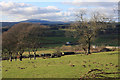
Annandale view
A view across Annandale, with a coal train heading north on the West Coast Main Line near Dinwoodie Mains.
Image: © Bob Cowan
Taken: 10 Mar 2009
0.07 miles
2
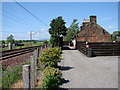
Station Cottage, Dinwoodie
Former railway cottages by the West Coast Main Line, by site of Dinwoodie Station (closed 1960).
Image: © Chris Newman
Taken: 4 Jun 2008
0.07 miles
3
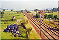
Site of Dinwoodie station, 1991
View northward, towards Beattock, Carstairs and Glasgow etc.: ex-Caledonian Railway section of the WCML up Annandale. The station was closed 13/6/60 to facilitate acceleration of express trains and the route was electrified in 1974.
Image: © Ben Brooksbank
Taken: 3 Sep 1991
0.08 miles
4
Dinwoodie Mains
The West Coast rail line passes just behind this farm. The '40s map shows a station here.
Image: © David Medcalf
Taken: 31 Mar 2006
0.17 miles
5
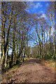
Dinwoodie Plantation
A new track has been constructed through this old wood.
Image: © Bob Cowan
Taken: 10 Mar 2009
0.23 miles
6
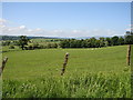
Dinwoodie - East
View from Broomhillbank Plantation across the grazing fields east of Dinwoodie Mains and the railway.
Image: © Chris Newman
Taken: 4 Jun 2008
0.23 miles