
IMAGES TAKEN NEAR TO
Boreland, LOCKERBIE, DG11 2LF
Introduction
This page details the photographs taken nearby to DG11 2LF by members of the Geograph project.
The Geograph project started in 2005 with the aim of publishing, organising and preserving representative images for every square kilometre of Great Britain, Ireland and the Isle of Man.

There are currently over 7.5m images from over14,400 individuals and you can help contribute to the project by visiting https://www.geograph.org.uk
Image Map
Images are licensed for reuse under creativecommons.org/licenses/by-sa/2.0
Notes
- Clicking on the map will re-center to the selected point.
- The higher the marker number, the further away the image location is from the centre of the postcode.
Image Listing (6 Images Found)
Images are licensed for reuse under creativecommons.org/licenses/by-sa/2.0
Image
Details
Distance
2
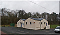
Boreland Village Hall
The community owned hall was built in the early 1950s. A three-phase refurbishment project was completed in October 2012. The first two phases upgraded the heating and existing kitchen, while the third phase was to build an extension (here, the part of the building closest to the camera) which houses new toilet facilities, storeroom and cloakroom.
Image: © Richard Dorrell
Taken: 9 Mar 2014
0.19 miles
3
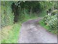
Track leading to Gillesbierigg
Looking noert-eastward.
Image: © Peter Wood
Taken: 9 Sep 2017
0.20 miles
4
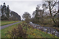
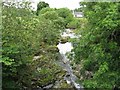
Dryfe Water
Looking upstream from close to Boreland village hall. The road on the left is a farm access road.
Image: © Richard Dorrell
Taken: 9 Mar 2014
0.21 miles
6
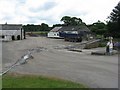
Hutton Mill at Boreland
A garage/hauliers' yard.
Image: © M J Richardson
Taken: 25 Jun 2010
0.23 miles