
IMAGES TAKEN NEAR TO
Mains Meadow, LOCKERBIE, DG11 2DE
Introduction
This page details the photographs taken nearby to Mains Meadow, DG11 2DE by members of the Geograph project.
The Geograph project started in 2005 with the aim of publishing, organising and preserving representative images for every square kilometre of Great Britain, Ireland and the Isle of Man.

There are currently over 7.5m images from over14,400 individuals and you can help contribute to the project by visiting https://www.geograph.org.uk
Image Map
Images are licensed for reuse under creativecommons.org/licenses/by-sa/2.0
Notes
- Clicking on the map will re-center to the selected point.
- The higher the marker number, the further away the image location is from the centre of the postcode.
Image Listing (133 Images Found)
Images are licensed for reuse under creativecommons.org/licenses/by-sa/2.0
Image
Details
Distance
1
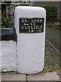
Old Milestone by the B723, Mains Street, Lockerbie, Dryfesdale Parish
By the B723(old A74), in parish of Dryfesdale (Annandale District), Lockerbie, corner of wall outside The Old Manse.
Inscription reads:- : GLASGOW / {arrow} 70 / CARLISLE / 24½ {arrow} :
Surveyed
Milestone Society National ID: DG_CLGW24
Image: © Milestone Society
Taken: Unknown
0.03 miles
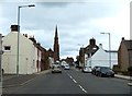
3
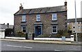
The Old Manse on east side of Mains Street
There is an old milestone Image at the wall corner on the right hand side of the house. It has Milestone Society National ID: DG_CLGW24
Image: © Roger Templeman
Taken: 24 Oct 2023
0.04 miles
4
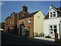
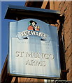
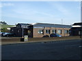
The St Mungo Arms, Lockerbie
On Mains Street.
Image: © JThomas
Taken: 3 Oct 2015
0.05 miles
7
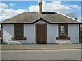
Former tollhouse
Surveyed by the Milestone Society. This small building is on the B723 into Lockerbie from the south at Townfoot. In 1822 it was bought by Major General Sharpe for £60 and converted into a tollhouse by John MacDonald for £119 11s 5d. In 1825 the tollkeeper was George McQueen and in 1851 Thomas Ivison. In 1857 it was crossed out in the OS Name Books so possibly no longer a tollhouse.
Image: © Alverie Weighill
Taken: 1 Aug 2015
0.10 miles
8
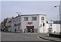
Lockerbie Post Office
Probably not the most attractive building in the town. It is located on the junction of Goods Station Road (on the right) and Main Street.
Image: © Richard Dorrell
Taken: 4 Mar 2013
0.11 miles
9
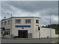
Lockerbie Antiques Centre
At the junction cross roads of B7068 and A709 near the town centre. I wondered how the Royal Mail sign and crown, dated 1964, linked to an antiques centre, but the Royal Mail delivery centre is round the back.
Image: © M J Richardson
Taken: 26 Apr 2022
0.11 miles
10
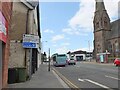
Dumfries Road, Lockerbie
The junction of the B723 Dumfries road and the A709 Carlisle road. The Roman Catholic Holy Trinity Church is to the right.
Image: © Jim Barton
Taken: 16 Jul 2021
0.11 miles