
IMAGES TAKEN NEAR TO
Well Vennel, LOCKERBIE, DG11 1NU
Introduction
This page details the photographs taken nearby to Well Vennel, DG11 1NU by members of the Geograph project.
The Geograph project started in 2005 with the aim of publishing, organising and preserving representative images for every square kilometre of Great Britain, Ireland and the Isle of Man.

There are currently over 7.5m images from over14,400 individuals and you can help contribute to the project by visiting https://www.geograph.org.uk
Image Map
Images are licensed for reuse under creativecommons.org/licenses/by-sa/2.0
Notes
- Clicking on the map will re-center to the selected point.
- The higher the marker number, the further away the image location is from the centre of the postcode.
Image Listing (112 Images Found)
Images are licensed for reuse under creativecommons.org/licenses/by-sa/2.0
Image
Details
Distance
1
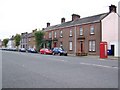
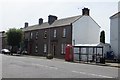
Street Scene, Lochmaben
Lochmaben is a Royal Borough and has strong connections with Robert the Bruce, his statue is in the town centre.
Image: © Maigheach-gheal
Taken: 10 Oct 2009
0.02 miles
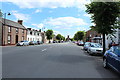
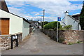
4
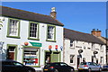
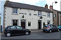
Post Office and Kings Arms Hotel, Lochmaben
Image: © Leslie Barrie
Taken: 11 Jun 2015
0.03 miles
7
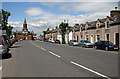
Lochmaben High Street
The town hall at the end of the street was built in 1723 and enlarged in the 1860s. The town was first documented in 1166 when William the Lion granted a charter to Robert Bruce, Earl of Annandale. (Source: Lochmaben Town Trail leaflet).
Image: © Walter Baxter
Taken: 24 Jun 2009
0.03 miles
9
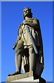
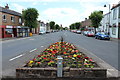
The Bruce
Statue of Robert the Bruce outside the town hall.
Image: © Colin Kinnear
Taken: 9 Mar 2009
0.03 miles
10
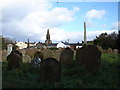
Lochmaben Old Churchyard
Site of the medieval parish church of St Mary Magdalene, now only headstones and obelisks dating from mid-C18 are visible in this overgrown burial ground.
Beyond is the spire of the town hall.
Image: © Chris Newman
Taken: 16 Oct 2008
0.04 miles