
IMAGES TAKEN NEAR TO
LOCKERBIE, DG11 1LT
Introduction
This page details the photographs taken nearby to DG11 1LT by members of the Geograph project.
The Geograph project started in 2005 with the aim of publishing, organising and preserving representative images for every square kilometre of Great Britain, Ireland and the Isle of Man.

There are currently over 7.5m images from over14,400 individuals and you can help contribute to the project by visiting https://www.geograph.org.uk
Image Map
Images are licensed for reuse under creativecommons.org/licenses/by-sa/2.0
Notes
- Clicking on the map will re-center to the selected point.
- The higher the marker number, the further away the image location is from the centre of the postcode.
Image Listing (5 Images Found)
Images are licensed for reuse under creativecommons.org/licenses/by-sa/2.0
Image
Details
Distance
1
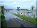
Flooded road near Halleaths
The "lake" beyond the gate is usually a much smaller pond. The pond often floods after heavy rain, but not so often to the extent that it covers the road, as it did on this occasion. I walked about 10 yards further along the road but decided it would be prudent to turn back then since the water had almost reached the tops of my wellies. See also Image and cf. Image
Image: © Lynne Kirton
Taken: 26 Oct 2008
0.05 miles
2
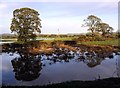
Reflections in flooded fields near Lochmaben
Heavy rain during the preceding week had caused quite severe flooding in the area, creating new temporary 'lakes'. The pond in the field in the foreground is a permanent feature, but on this occasion was much deeper than usual.
Image: © Lynne Kirton
Taken: 5 Nov 2005
0.08 miles
3
Pastoral scene
Farmland near Halleaths.
Image: © Lynne Kirton
Taken: 19 May 2007
0.08 miles
4
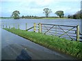
Flooding near Halleaths
Beyond the gate is a pond, increased in size many times by floodwater after a prolonged spell of torrential rain and gale force winds. The pond often floods after heavy rain, but not so often to the extent that it covers the road running alongside it, as it did on this occasion. Cf. Image
Image: © Lynne Kirton
Taken: 26 Oct 2008
0.09 miles
5
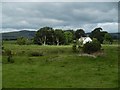
View over the Annan
Grazing land in Annandale.
Image: © Richard Webb
Taken: 27 Jul 2016
0.18 miles