IMAGES TAKEN NEAR TO
Templand, LOCKERBIE, DG11 1EW
Introduction
This page details the photographs taken nearby to DG11 1EW by members of the Geograph project.
The Geograph project started in 2005 with the aim of publishing, organising and preserving representative images for every square kilometre of Great Britain, Ireland and the Isle of Man.

There are currently over 7.5m images from over14,400 individuals and you can help contribute to the project by visiting https://www.geograph.org.uk
Image Map
Images are licensed for reuse under creativecommons.org/licenses/by-sa/2.0
Notes
- Clicking on the map will re-center to the selected point.
- The higher the marker number, the further away the image location is from the centre of the postcode.
Image Listing (7 Images Found)
Images are licensed for reuse under creativecommons.org/licenses/by-sa/2.0
Image
Details
Distance
1
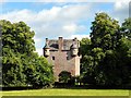
Spedlin's Tower
Former seat of the Jardine family, Spedlin's Tower is a fortified Scottish tower house dating from the 15th century. Abandoned in the early 19th century, it was reroofed and restored in the 1980s and is now in private ownership.
Image: © Lynne Kirton
Taken: 29 Aug 2016
0.05 miles
2
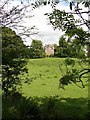
Spedlins Tower
Substantial tower house (c.1500) of the Jardines of Applegarth. Extended upwards 1605, restored 1988-9.
Image: © Chris Newman
Taken: 10 Jun 2007
0.08 miles
3
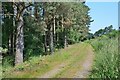
Pines by the track
Pine trees border the track around the east side of Spedlin's Flow, a level wooded area.
Image: © Jim Barton
Taken: 17 Jul 2021
0.14 miles
4
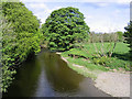
The River Annan
Viewed from a bridge near Spedlins Tower.
Image: © Walter Baxter
Taken: 14 May 2007
0.15 miles
6
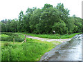
Annandale Way near Spedlins Tower
The Annandale Way long distance trail leaves the road here to follow the track to the left.
Image: © Oliver Dixon
Taken: 7 Jun 2014
0.24 miles