
IMAGES TAKEN NEAR TO
Kettleholm, LOCKERBIE, DG11 1BU
Introduction
This page details the photographs taken nearby to DG11 1BU by members of the Geograph project.
The Geograph project started in 2005 with the aim of publishing, organising and preserving representative images for every square kilometre of Great Britain, Ireland and the Isle of Man.

There are currently over 7.5m images from over14,400 individuals and you can help contribute to the project by visiting https://www.geograph.org.uk
Image Map
Images are licensed for reuse under creativecommons.org/licenses/by-sa/2.0
Notes
- Clicking on the map will re-center to the selected point.
- The higher the marker number, the further away the image location is from the centre of the postcode.
Image Listing (18 Images Found)
Images are licensed for reuse under creativecommons.org/licenses/by-sa/2.0
Image
Details
Distance
1
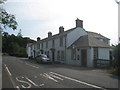
Kettleholm Cottages
Listed Category B http://www.britishlistedbuildings.co.uk/sc-16904-kettleholm-village-1-4-kettleholm-cottage#.VtCyn9CWOTw
Image: © Jonathan Thacker
Taken: 22 Jul 2013
0.02 miles
2
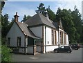
Kettleholm Village Hall
A striking building of 1907 http://www.britishlistedbuildings.co.uk/sc-16905-kettleholm-village-kettleholm-village-hal#.VtCz1NCWOTw
Image: © Jonathan Thacker
Taken: 22 Jul 2013
0.02 miles
4
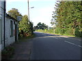
Bus stop on the B723, Kettleholm
Looking north.
Image: © JThomas
Taken: 3 Oct 2015
0.04 miles
5
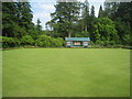
Bowling Green, Kettleholm
A tennis court is adjacent.
Image: © Jonathan Thacker
Taken: 22 Jul 2013
0.06 miles
6
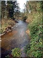
The Water of Milk
A tributary of the R. Annan, taken from the bridge at Kettleholm.
Image: © Lynne Kirton
Taken: 18 Apr 2006
0.06 miles
7
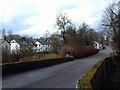
Kettleholm
Small village close to the A 74(M). Picture taken from the bridge over the Water of Milk.
Image: © Lynne Kirton
Taken: 18 Apr 2006
0.06 miles
8
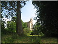
The tower of St. Mungo, Kettleholm between the trees
The architect was David Bryce and the church dates from 1874-7. http://www.britishlistedbuildings.co.uk/sc-16885-st-mungo-parish-church-church-of-scotland#.VtCOAtCWOTw
Image: © Jonathan Thacker
Taken: 22 Jul 2013
0.10 miles
9
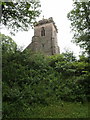
St Mungo Parish Church
The church, on a knoll above the Water of Milk valley at Kettleholm, is described as "Late Scots Gothic by David Bryce 1877" (http://guide.visitscotland.com/vs/guide/5,en,SCH1/objectId,INF52607Svs,curr,GBP,season,at1,selectedEntry,home/home.html ), although other sources give other dates in the 1870s.
Image: © Derek Harper
Taken: 4 Jul 2007
0.11 miles
10
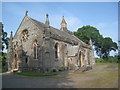
The parish church of St. Mungo, Kettleholm
Situated on a low mound above the road and thus more prominent than its size would suggest. The architect was David Bryce and the church dates from 1874-7. http://www.britishlistedbuildings.co.uk/sc-16885-st-mungo-parish-church-church-of-scotland#.VtCOAtCWOTw
Image: © Jonathan Thacker
Taken: 22 Jul 2013
0.11 miles