IMAGES TAKEN NEAR TO
Hoddom, LOCKERBIE, DG11 1AL
Introduction
This page details the photographs taken nearby to DG11 1AL by members of the Geograph project.
The Geograph project started in 2005 with the aim of publishing, organising and preserving representative images for every square kilometre of Great Britain, Ireland and the Isle of Man.

There are currently over 7.5m images from over14,400 individuals and you can help contribute to the project by visiting https://www.geograph.org.uk
Image Map
Images are licensed for reuse under creativecommons.org/licenses/by-sa/2.0
Notes
- Clicking on the map will re-center to the selected point.
- The higher the marker number, the further away the image location is from the centre of the postcode.
Image Listing (10 Images Found)
Images are licensed for reuse under creativecommons.org/licenses/by-sa/2.0
Image
Details
Distance
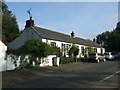
1
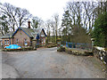
Lodge to the Whitehill estate
Beside the B723.
Image: © Oliver Dixon
Taken: 17 Mar 2014
0.02 miles
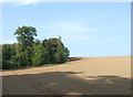
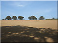
3
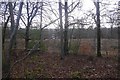
A strip wood, Whitehill
A roadside strip on the corner of the square.
Image: © Richard Webb
Taken: 5 Mar 2017
0.09 miles
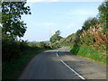
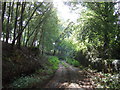
4
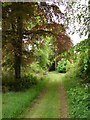
Whitehill Track
Woodland track leads through northern part of the Whitehill estate at Middleshaw.
Image: © Chris Newman
Taken: 18 May 2008
0.11 miles
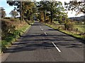
6
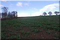
Oilseed rape on Bar Hill
A rather sparse crop
Image: © Richard Webb
Taken: 5 Mar 2017
0.13 miles