IMAGES TAKEN NEAR TO
MOFFAT, DG10 9LE

Introduction

This page details the photographs taken nearby to DG10 9LE by members of the Geograph project.

The Geograph project started in 2005 with the aim of publishing, organising and preserving representative images for every square kilometre of Great Britain, Ireland and the Isle of Man.

There are currently over 7.5m images from over14,400 individuals and you can help contribute to the project by visiting https://www.geograph.org.uk

Image Map


Images are licensed for reuse under creativecommons.org/licenses/by-sa/2.0
Notes
  • Clicking on the map will re-center to the selected point.
  • The higher the marker number, the further away the image location is from the centre of the postcode.

Image Listing (10 Images Found)

Images are licensed for reuse under creativecommons.org/licenses/by-sa/2.0
Image
Details
Distance
1
Hunterheck
Image: © Anthony Parkes Taken: 23 Sep 2016
0.01 miles
2
A708, Hunterheck
Heading around Hillend and towards Moffat Dale.
Image: © Richard Webb Taken: 26 Aug 2013
0.03 miles
3
Frenchland Burn from bridge over the A708 Moffat to Selkirk Road
Taken only slightly later in the day than http://www.geograph.org.uk/photo/2763627 on a much more wintry day.
Image: © Alan O'Dowd Taken: 4 Feb 2012
0.04 miles
4
Frenchland Burn from bridge over the A708 Moffat to Selkirk Road
This burn is a tributary of the River Annan. The remains of Frenchland Tower can be seen on the left hand side of the burn in the background.
Image: © Alan O'Dowd Taken: 14 Jan 2012
0.04 miles
5
Beside the Frenchland Burn
Annandale grassland just outside Moffat.
Image: © Richard Webb Taken: 26 Aug 2013
0.07 miles
6
A pair of white houses near Moffat
Sitting just off the A708 road.
Image: © James Denham Taken: 17 Mar 2009
0.09 miles
7
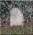
Old Milestone by the A708, Hunterheck
Carved stone post by A708, Dumfries and Galloway, Hunterheck Farm, on verge, South side of road. 19th Century stone. Inscription reads:- Selkirk 33 Moffat 1 Milestone Society National ID: DG_SKMF33.
Image: © Milestone Society Taken: 1 Dec 2017
0.11 miles
8
Cattle and farm buildings at Hunterheck
Image: © Leslie Barrie Taken: 21 Apr 2015
0.15 miles
9
View to the east of Moffat with Frenchlands tower
Image: © Andrew King Taken: 30 Sep 2010
0.17 miles
10
A shed at Frenchland Farm
This shed was viewed from the A701.
Image: © Walter Baxter Taken: 12 Jan 2012
0.23 miles