
IMAGES TAKEN NEAR TO
Warwick Drive, ILKESTON, DE7 9JE
Introduction
This page details the photographs taken nearby to Warwick Drive, DE7 9JE by members of the Geograph project.
The Geograph project started in 2005 with the aim of publishing, organising and preserving representative images for every square kilometre of Great Britain, Ireland and the Isle of Man.

There are currently over 7.5m images from over14,400 individuals and you can help contribute to the project by visiting https://www.geograph.org.uk
Image Map
Images are licensed for reuse under creativecommons.org/licenses/by-sa/2.0
Notes
- Clicking on the map will re-center to the selected point.
- The higher the marker number, the further away the image location is from the centre of the postcode.
Image Listing (8 Images Found)
Images are licensed for reuse under creativecommons.org/licenses/by-sa/2.0
Image
Details
Distance
1
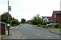
Pentridge Drive, Shipley Common
Part of the large late 20th century housing development in the northern part of Ilkeston.
Image: © Alan Murray-Rust
Taken: 28 Jul 2017
0.07 miles
2
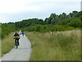
On the Nutbrook Trail
It's difficult to reconcile this view with the fact that it was once an area of coal mines. The trail is part of Sustrans cycle route 67.
Image: © Alan Murray-Rust
Taken: 28 Jul 2017
0.10 miles
3
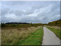
National Cycle Route 67 West of Shipley Common, Ilkeston
The low hill visible on the left in the middle distance is the site of Shipley Country Park.
Image: © Oxymoron
Taken: 14 Oct 2008
0.11 miles
4

Wasteland West of Shipley Common, Ilkeston
The two horse riders just visible in the middle distance are riding along a track, unmarked on the OS map, which lies between the marked cycle route (from which the photo was taken) and the six ponds.
Image: © Oxymoron
Taken: 14 Oct 2008
0.13 miles
5
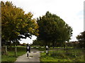
Western Edge of Ilkeston
The gate marks the beginning of a footpath leading from NCN 67 into Shipley Common.
Image: © Oxymoron
Taken: 14 Oct 2008
0.16 miles
6
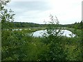
Settling ponds, Shipley Common
Used to settle pumped water from the former coal mines in the area.
Image: © Alan Murray-Rust
Taken: 28 Jul 2017
0.18 miles
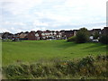
8
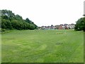
Barling Drive Lagoon
Local recreation area, the low lying section in the foreground also serves as a floodwater catchment area.
Image: © Alan Murray-Rust
Taken: 28 Jul 2017
0.20 miles