
IMAGES TAKEN NEAR TO
Richmond Avenue, ILKESTON, DE7 8QY
Introduction
This page details the photographs taken nearby to Richmond Avenue, DE7 8QY by members of the Geograph project.
The Geograph project started in 2005 with the aim of publishing, organising and preserving representative images for every square kilometre of Great Britain, Ireland and the Isle of Man.

There are currently over 7.5m images from over14,400 individuals and you can help contribute to the project by visiting https://www.geograph.org.uk
Image Map
Images are licensed for reuse under creativecommons.org/licenses/by-sa/2.0
Notes
- Clicking on the map will re-center to the selected point.
- The higher the marker number, the further away the image location is from the centre of the postcode.
Image Listing (57 Images Found)
Images are licensed for reuse under creativecommons.org/licenses/by-sa/2.0
Image
Details
Distance
1
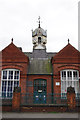
Former Bennerley School, Cotmanhay
This former school building dates from 1892 when it opened as the Cotmanhay Road Infant's School. It is now the Cotmanhay & Ilkeston Adult Community Education Centre.
Image: © Stephen McKay
Taken: 23 Feb 2014
0.07 miles
2

Cotmanhay Road, Cotmanhay
Looking along Cotmanhay Road from its junction with Milton Street towards Ilkeston.
Image: © Stephen McKay
Taken: 23 Feb 2014
0.08 miles
3
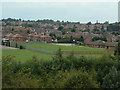
Cotmanhay
Large council estate on the north of Ilkeston, seen from the embankment of Bennerley Viaduct with Bennerley Fields School in the foreground.
Image: © Alan Murray-Rust
Taken: 16 Jul 2009
0.09 miles
4

Bridge Street, Cotmanhay
Looking east from the end of Cotmanhay Road.
Image: © Richard Vince
Taken: 24 Feb 2015
0.12 miles
5
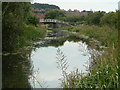
Erewash canal at Bennerley
Looking north towards the Bridge Inn.
Image: © Alan Murray-Rust
Taken: 16 Jul 2009
0.14 miles
6

The Bridge Inn, Cotmanhay
Located right by Cotmanhay Bridge on the Erewash Canal, at the end of Bridge Street, this delightful traditional pub is ideal for locals and boaters alike.
Image: © Stephen McKay
Taken: 25 Jan 2017
0.14 miles
7

The Bridge Inn, Cotmanhay
http://www.geograph.org.uk/photo/5038790
Image: © Ian S
Taken: 16 Jul 2016
0.14 miles
8
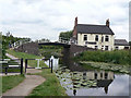
Bridge Inn
This is the Bridge Inn at Cotmanhay, taking its name from the bridge over the Erewash Canal. A feature of the bridge is the newer brickwork in the upper parts of the abutments. This became necessary to maintain headroom under the bridge as the level of the land sank due to mining subsidence in the area.
Image: © Alan Murray-Rust
Taken: 16 Jul 2009
0.14 miles
9

The Bridge Inn, Cotmanhay
http://www.geograph.org.uk/photo/5038767
Image: © Ian S
Taken: 16 Jul 2016
0.14 miles
10
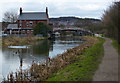
The Bridge Inn and Bridge No 23
Crossing the Erewash Canal in the Cotmanhay area of Ilkeston.
Image: © Mat Fascione
Taken: 28 Feb 2016
0.14 miles