
IMAGES TAKEN NEAR TO
High Lane East, ILKESTON, DE7 6HZ
Introduction
This page details the photographs taken nearby to High Lane East, DE7 6HZ by members of the Geograph project.
The Geograph project started in 2005 with the aim of publishing, organising and preserving representative images for every square kilometre of Great Britain, Ireland and the Isle of Man.

There are currently over 7.5m images from over14,400 individuals and you can help contribute to the project by visiting https://www.geograph.org.uk
Image Map
Images are licensed for reuse under creativecommons.org/licenses/by-sa/2.0
Notes
- Clicking on the map will re-center to the selected point.
- The higher the marker number, the further away the image location is from the centre of the postcode.
Image Listing (37 Images Found)
Images are licensed for reuse under creativecommons.org/licenses/by-sa/2.0
Image
Details
Distance
1

High Lane East, West Hallam
Housing straggles along High Lane for most of the way between Ilkeston and West Hallam. The white marks on the tree indicate the entrance to Nutbrook Cricket Club ground.
Image: © Stephen McKay
Taken: 12 Nov 2011
0.04 miles
2

Former Railway
The former Great Northern Railway line, now part of the local footpath network around Strawsbridge ponds.
Image: © Jay Pea
Taken: 27 Aug 2025
0.06 miles
3

Nutbrook Cricket Club
Nutbrook Cricket Club was founded in 1937 but only moved to this ground off High Lane East in 1985.
Image: © Stephen McKay
Taken: 12 Nov 2011
0.08 miles
4

High Lane East
Heading towards West Hallam with Ilkeston behind us with some quite impressive cumulus clouds ahead.
Image: © Malcolm Neal
Taken: 29 Apr 2021
0.09 miles

6

Footpath on an old railway line
West Hallam Footpath 29 runs on a length of former railway that once connected the Great Northern Railway with the mineral line to West Hallam Colliery.
Image: © Ian Calderwood
Taken: 3 Apr 2025
0.10 miles
7

Bus stop on High Lane East
The A609 towards Ilkeston.
Image: © JThomas
Taken: 29 Jun 2019
0.10 miles
8
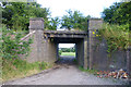
Footpath under a dismantled railway
A former Great Northern Railway line. Part of the Derby branch the most spectacular feature of which was the Bennerley Viaduct in Image More on this line here http://en.wikipedia.org/wiki/GNR_Derbyshire_and_Staffordshire_Extension .
Image: © David Lally
Taken: 30 Jul 2013
0.12 miles
9

Bridge and bricks
The bridge carried the former Great Northern Railway Derbyshire Extension (Nottingham to Derby) over a farm track which is also a public footpath.
Image: © Alan Murray-Rust
Taken: 28 Jul 2017
0.12 miles
10

The Centenary Way Approaching High Lane
Saturated, chewed up grazing area and indistinct path leading up to High Lane from the Nutbrook Trail. According to the friendly but watchful landowners the path actually runs diagonally across this field, joining the main road to the left of the stables ahead.
Image: © Jonathan Clitheroe
Taken: 18 Jan 2014
0.15 miles