IMAGES TAKEN NEAR TO
Graham Street, ILKESTON, DE7 5ND

Introduction

This page details the photographs taken nearby to Graham Street, DE7 5ND by members of the Geograph project.

The Geograph project started in 2005 with the aim of publishing, organising and preserving representative images for every square kilometre of Great Britain, Ireland and the Isle of Man.

There are currently over 7.5m images from over14,400 individuals and you can help contribute to the project by visiting https://www.geograph.org.uk

Image Map


Images are licensed for reuse under creativecommons.org/licenses/by-sa/2.0
Notes
  • Clicking on the map will re-center to the selected point.
  • The higher the marker number, the further away the image location is from the centre of the postcode.

Image Listing (134 Images Found)

Images are licensed for reuse under creativecommons.org/licenses/by-sa/2.0
  • ...
Image
Details
Distance
1
Park Road, Ilkeston
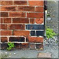
There is a bench mark http://www.geograph.org.uk/photo/5497540 on the building to the left.
Image: © Alan Murray-Rust Taken: 11 Aug 2017
0.05 miles
2
Bench mark, 81 Park Road, Ilkeston
See http://www.geograph.org.uk/photo/5497543 for location and details.
Image: © Alan Murray-Rust Taken: 11 Aug 2017
0.05 miles
3
Flats on Chalons Way Ilkeston
Image: © JThomas Taken: 29 Jun 2019
0.08 miles
4
Ilkeston, DE7
Park Avenue on the left (2 mins away from Park Cemetery) is seen here joining Park Road with the single storey "Sudbury Memorial Homes" (almshouse) at the junction. These were built in 1910 as a memorial to Francis Sudbury Jnr., who was born in Ilkeston in 1842 and elected Ilkeston's first Mayor in 1887. Francis Sudbury Snr. was a hosiery and glove manufacturer.
Image: © David Hallam-Jones Taken: 19 Jan 2013
0.09 miles
5
White Lion Square, Ilkeston
Roundabout at junction of A609, A6096 and A6007. A telecomms mast and signs for town centre parking.
Image: © Peter Barr Taken: 8 Dec 2014
0.10 miles
6
Nottingham Road in Ilkeston
Image: © Mat Fascione Taken: 28 Feb 2016
0.10 miles
7
Chalons Way, Ilkeston
The A6007.
Image: © JThomas Taken: 29 Jun 2019
0.10 miles
8
Ilkeston DE7, Derbys
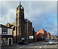
This view along the near-summit section of Nottingham Road (the A690), with the Toll Bar roundabout on the plateau ahead, provide a good view of the Roman Catholic Church of Our Lady of Dale & St Thomas of Hereford at the junction of Regent Street. The church is of stone in Early English Gothic style with a slender tower topped with a crown-like spire. The present 1920-30s building was designed by Charles W Hunt and is of Darley Dale stone with a slate roof.
Image: © David Hallam-Jones Taken: 31 Jan 2013
0.12 miles
9
Roman Catholic Church of Our Lady and St Thomas of Hereford, Ilkeston
The church was built to replace an earlier building in the 1920s and 30s. The crown on the tower is reminiscent of many Scottish churches, but is thought to take its inspiration from St Dunstan-in-the-East in London. St Thomas of Hereford was Chancellor of England during the 13th century. He was a member of the Cantelupe family who held the Manor of Ilkeston at the time.
Image: © Alan Murray-Rust Taken: 11 Aug 2017
0.12 miles
10
Roman Catholic Church of Our Lady and St Thomas of Hereford, Ilkeston
Foundation stone on the Regent Street face. See http://www.geograph.org.uk/photo/5497523 for location.
Image: © Alan Murray-Rust Taken: 11 Aug 2017
0.13 miles
  • ...