
IMAGES TAKEN NEAR TO
Brookfield Way, HEANOR, DE75 7NX
Introduction
This page details the photographs taken nearby to Brookfield Way, DE75 7NX by members of the Geograph project.
The Geograph project started in 2005 with the aim of publishing, organising and preserving representative images for every square kilometre of Great Britain, Ireland and the Isle of Man.

There are currently over 7.5m images from over14,400 individuals and you can help contribute to the project by visiting https://www.geograph.org.uk
Image Map
Images are licensed for reuse under creativecommons.org/licenses/by-sa/2.0
Notes
- Clicking on the map will re-center to the selected point.
- The higher the marker number, the further away the image location is from the centre of the postcode.
Image Listing (5 Images Found)
Images are licensed for reuse under creativecommons.org/licenses/by-sa/2.0
Image
Details
Distance
1
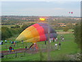
Balloon landing at Laceyfields Road
Looking across the Erewash towards Eastwood
Image: © Q
Taken: 18 Jul 2004
0.12 miles
2
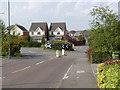
Meadow Gardens, Heanor
Modern housing on the eastern edge of the town.
Image: © Alan Murray-Rust
Taken: 13 Jul 2013
0.18 miles
3
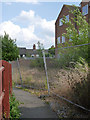
Footpath and empty flats
The flats appear to have been built a few years ago and never occupied.
Image: © Alan Murray-Rust
Taken: 13 Jul 2013
0.21 miles
4
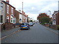
Heading north east on Breach Road
Towards Langley Mill.
Image: © JThomas
Taken: 20 Oct 2015
0.22 miles
5

The bottom of Lee Lane
Created when the new railway bridge was built http://www.geograph.org.uk/photo/3556294 .
Image: © Alan Murray-Rust
Taken: 13 Jul 2013
0.24 miles