1
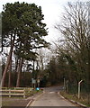
Nutbrook Trail, Marlpool
This footpath and cycleway uses the trackbed of the Great Northern Railway's Heanor branch which lost its passenger service as long ago as 1928, although freight trains ran until 1963. A group of dog walkers heads off towards Heanor.
Image: © Stephen McKay
Taken: 19 Apr 2009
0.04 miles
2
Nutbrook Trail, Marlpool
The former Heanor branch of the Great Northern Railway is now used as a footpath and cycleway. Passenger services were withdrawn as early as 1928 - incidentally, making Heanor one of the first towns in the country to be deprived of a train service, the LMS station having been closed two years earlier. Frequent tram and bus services in the area at that time no doubt led to the railway's demise. Freight services continued until 1963, however.
Image: © Stephen McKay
Taken: 19 Apr 2009
0.04 miles
3
Shipley Country Park, Heanor, Derbys.
A view of a former railway bridge as seen from Shipley Lane. Beyond the bridge, that now carries a footpath, lies Roper Avenue and Buxton Avenue, Marlpool. The low wooden fence partially surrounds an exposed overflow conduit from Osborne's Pond. The road to the right leads to a road, and slightly confusingly a hamlet of the same name, known as The Field.
Image: © David Hallam-Jones
Taken: 8 Feb 2013
0.05 miles
4
Shipley Country Park, Heanor, Derbys.
A view across Osborne's Pond from near the junction of Buxton Avenue and Shipley Lane.
Image: © David Hallam-Jones
Taken: 8 Feb 2013
0.06 miles
5
Osborne's Pond, Shipley Park
This small body of water was originally created as a feeder for the Nutbrook Canal, which was constructed in 1791. The canal is now defunct, but the pond remains as an integral part of Shipley Park and is popular with fishermen.
Image: © Stephen McKay
Taken: 19 Apr 2009
0.07 miles
6
Osborne's Pond, Shipley Park
Osborne's Pond is seen here close to the park's access from Marlpool.
Image: © Stephen McKay
Taken: 19 Apr 2009
0.09 miles
7
Scots Pine in Shipley Country Park
Seen here overlooking Osborne's Pond on a fine Saturday in late July.
Image: © Jonathan Clitheroe
Taken: 28 Jul 2012
0.10 miles
8
Frederic Avenue, Marlpool
Social housing at Marlpool in Derbyshire.
Image: © Martin Froggatt
Taken: 14 Jul 2018
0.10 miles
9
Shipley Country Park - Osborne's Pond Overflow View
Image: © Alan Heardman
Taken: 8 Feb 2008
0.10 miles
10
Osborne's Pond, Shipley Park
Originally a feeder reservoir to the Nutbrook Canal which served the Shipley Hall collieries. Now part of Shipley Country Park.
Image: © Alan Murray-Rust
Taken: 17 Jul 2017
0.10 miles


